

The Cape Wrath Trail, although unofficial in it's status as a long distance walking route, is widely regarded as the toughest hiking trail in Britain. Whether scrambling up steep hillsides, wading through wide rivers or navigating across pathless moors and marshland, this 200 mile trek from Fort William to Cape Wrath is a force to be reckoned with. On the flip side, this is one of the most stunningly beautiful and dramatic walking routes you will find anywhere in the UK. The trail weaves naturally through hidden valleys and glens amidst ancient woodland and high, jagged, snow peaked mountains; which suddenly open out to wonderful views of distant Hebridean islands and fjord-like sea lochs. Once you have attempted the Cape Wrath Trail, in part or in full, the experience will be one which will never forget.
The Team: Ross Mackey, Donna Mackey, Ellie Forgan, Gary Sloan, Kenny Falconer, Kenny Watt, Alan Gray, Niall Aitken, Steven Oliver, Chris McCulloch.
Our Challenge
Having successfully completed a West Highland Way Run & Cycle in 2014, where we raised almost £5,000 for Cancer Research UK, we decided that this year, it was time to up the stakes. The team included a few rather inexperienced new 'recruits', who all knew from an early stage that this would be a challenge in every sense of the word.
Having failed in a similar Cape Wrath attempt some 10 years earlier, I was keen to settle a few demons and conquer the trail this time around, while also raising funds for the wonderful children's cancer charity, CLIC Sargent. The challenge was to complete a 70 mile section of the trail over 3 days, from Glenfinnan to Strathcarron, with full hiking and camping gear to boot. I had to set the bar high as it was important that to convey the idea that this was no walk in the park , otherwise the event could have been perceived as a walking 'holiday' rather than a charity fundraiser. To many, 70 miles in 72 hours may not seem like the most gruelling challenge, but try telling that to the ten battle scarred and emotionally drained souls who started out on this epic event.
Before recalling this amazing journey, I'd just like to commend the spirit of the team and say how immensely proud I am of every single person. There were times when they were truly hurting and I applaud their 'mind over matter' attitude from start to finish.
Day 1 - Glenfinnan to River Carnach, 25 miles 1,264 metres climb
After arriving at the Myrtle Bank Guest House at 6pm the previous evening, we quickly dumped our bags and headed for the Great Glen Pub, adjacent to the WHW finish point in Gordon Square. After some excellent grub and one or two pints (excellent prices) we decided to venture elsewhere. The first pub, The Ben Nevis Bar, proved to be an interesting choice. We were greeted by a very drunk and very loud, southern English bloke. Our initial impression of him being 'one of the lads' soon diminished as he was accompanied by this very small dog, to which he showed no shame in cradling, kissing and hugging like a new born baby. It turned out he was on road trip with his brother and this tiny pooch, and the seemed hell bent on splashing out money on the locals, offering drinks and shots like there was no tomorrow - very odd!! After a swift exit, the Grog & Gruel Pub was a welcome change, particularly as a local gentleman spotted our CLIC Sargent t-shirts and gave us £5 towards our fundraising efforts.
Next morning, the 06:15 alarm signalled the start of our epic three day journey and we were soon in the taxi en-route to Glenfinnan. "No turning back now" was the general feeling as we all lumped on our heavy packs and started the walk under the famous Glenfinnan Viaduct. Not five minutes had passed when a 4x4 Landrover sped towards us and, after stopping a few yards short, out popped a rather official looking gentleman. I've had one or two experiences with highland land owners over the years and I was a bit wary over where this conversation might be headed. My concerns, however, were completely unfounded as he was very pleasant and seemed genuinely interested in our story. He even gave us £10 to add to the CLIC Sargent pot. What a great way to start the hike.
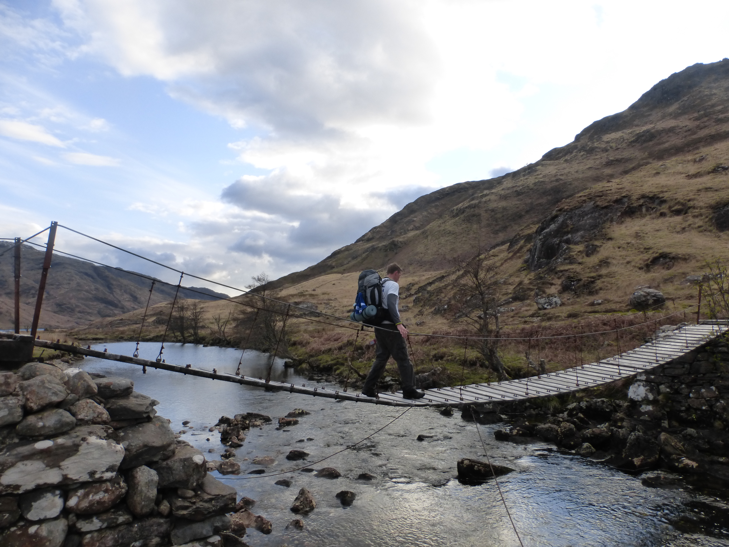
The first couple of miles followed an asphalt or tarmac road, however, this didn't detract from the beauty of our surroundings. It was a lovely sunny morning and I sensed that everyone had a real spring in their step - how hard can this walking lark really be? We passed the Corryhully bothy and Glenfinnan Lodge in good time. Soon after, the road made way for a more typical mountain path and, after crossing a dodgy makeshift bridge we headed for the mountain pass (or bealach), our highest point of the day (471 metres). The path to the bealach had been the perfect way of introducing us to the trail as this would very typical of the terrain throughout the walk. At the top of the bealach, the views down towards Strathan were spectacular. A long straight glen lay ahead, surrounded by snow tipped mountains on all sides and a river cutting straight down the centre. The moment was spoiled somewhat after Donna suggested the shape of the hill ahead resembled a particular part of the female anatomy. After a tricky little descent, we continued down the boggy hillside glen before leading to a bridge across the River Pean. On looking over the edge of the bridge to the river below, a large and very inviting 'plunge pool' appeared. It was too good an opportunity to miss. The sun was still shining with not a cloud in the sky - it was time to strip down to the boxers and go for a dip. Oh my goodness the water was 'take your breath away' freezing cold. Deep pools of water such as this are always very tempting but it's never quite as enjoyable immediately after jumping in and realising that the water is literally ice cold. Gary took things a step further by jumping from the top of the bridge, some 15 feet above the water. Luckily for him, the water was deep enough for a jump from that height. The group stopped here for lunch before setting off into the forest of Glendessaray and on to Loch Nevis.
The walk through Glendessaray and up to the bealach was a delightful section. The sun was still shining and the surrounding atmosphere was so still and peaceful. By now, we were in the heart of the mountains and, should the weather turn, at the true mercy of the Scottish Highlands. With no civilisation for miles in any direction; it was impossible not to embrace the moment and appreciate the beauty and grandeur of our surroundings. There are times when all the photos and journals in the world will never truly describe the moment and trying to think of ways to explain to the people back home just how awesome this place really would be a hard task - we just had to enjoy it together. The path which leads from Glendessaray to Sourlies is a lovely little trail, created by centuries of constant use as it naturally follows the contours of the land. I remember having a conversation with the group as we wondered who would have used this trail over the years? Loch Nevis would have been perfect for smugglers to bring their haul far inland before carting off the loot towards Fort William and beyond (that was the most exciting idea anyway). The descent to the shores of Loch Nevis and Sourlies bothy was quite steep, although the zig-zag effect did make it a bit easier on the old knees. It is very easy to forget the aches and pains for a moment as the views down to the loch were stunning. At this stage late in the afternoon, the team were beginning to tire, conversations were less frequent and energised, and the gap between front and back was widening. In all fairness, we had been walking since 7:30am and it was now after 6pm. Little did the guys know, however, that the hardest trudge of the day was still to come.
There is one thing you can never tell from a map and that is just how wet and boggy the land is underfoot. Around the corner from Sourlies is Carnoch, a wide flat plain, which I can only assume used to be either part of a once wider River Carnoch or an extension to the nearby Loch Nevis. The map highlights a path here but in reality, any route through was reclaimed by nature a long time ago . The going was extremely boggy and swamp-like, where one wrong step meant you were waist deep in swamp. Navigating through here was time consuming and extremely tiresome, both mentally and physically. It probably took an hour to travel less than a mile. At the other side, we crossed the very unstable and 'unsafe for use' bridge over the River Carnach before re-grouping and pushing on, drained of energy, towards camp. Most of the team had simply had enough for the day and were completely running on empty. Unfortunately, we still had a couple of miles to go upstream and back into the mountains. I had previously mapped out a point where a wide and flat sheltered spot would have been the perfect camping spot, however, it was getting dark, the clouds were beginning to gather, and we were still walking. I was becoming increasingly concerned as we should reached the campsite before now. Exhausted, tired and hungry, we eventually found a suitable pitch, but it was still at least half a mile short of the intended campsite but some of the team simply couldn't go a stuff further. Everyone put up their tents and quickly disappeared inside, not to be seen or heard from until the following day. There was no chatting amongst the group or reminiscing over what had been an amazing day - just silence! The challenge was already beginning to take its toll.
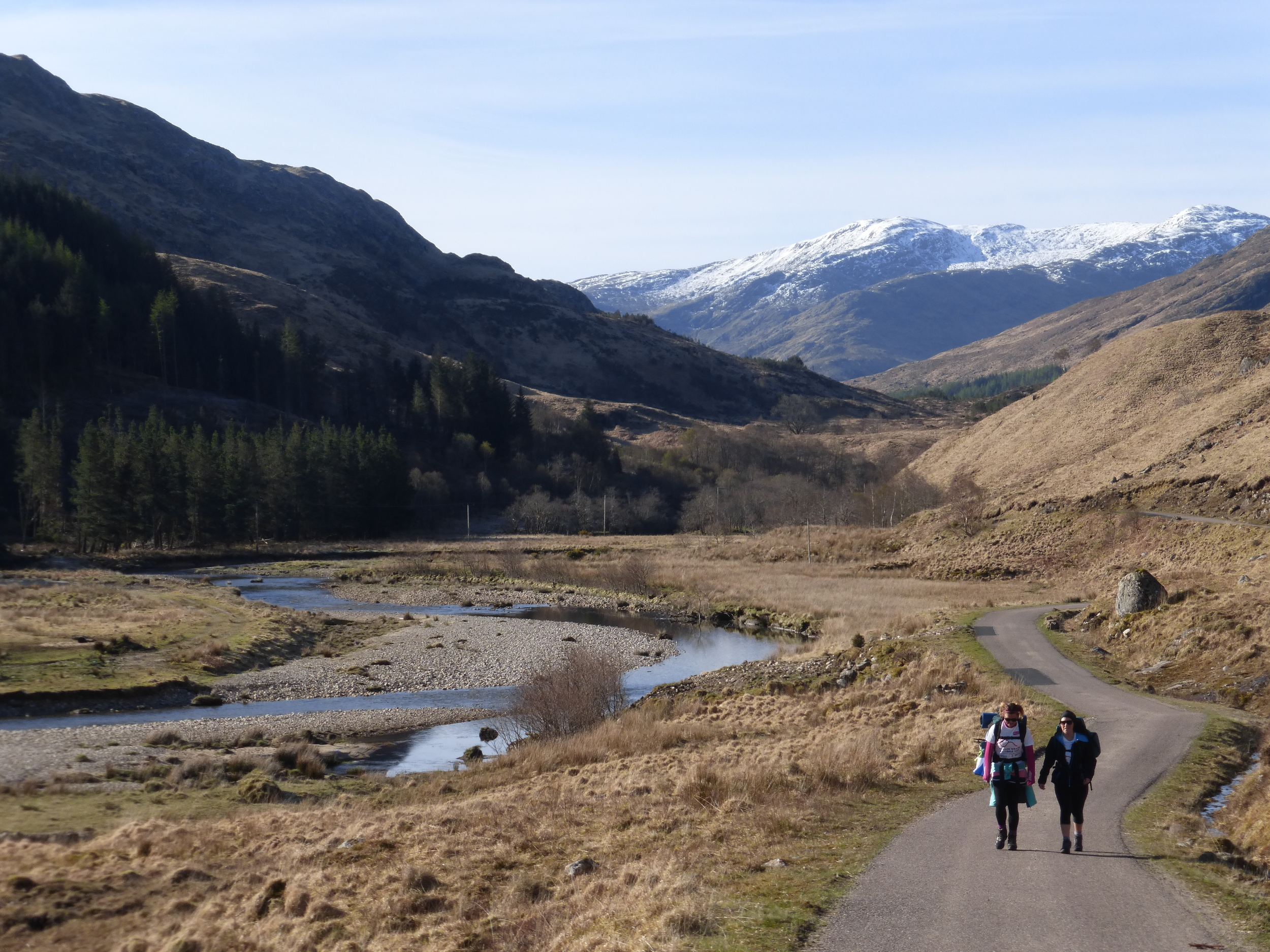
Donna and Ellie on the track from Glenfinnan
Nearly at the top of the climb along Gleann Cuirnean

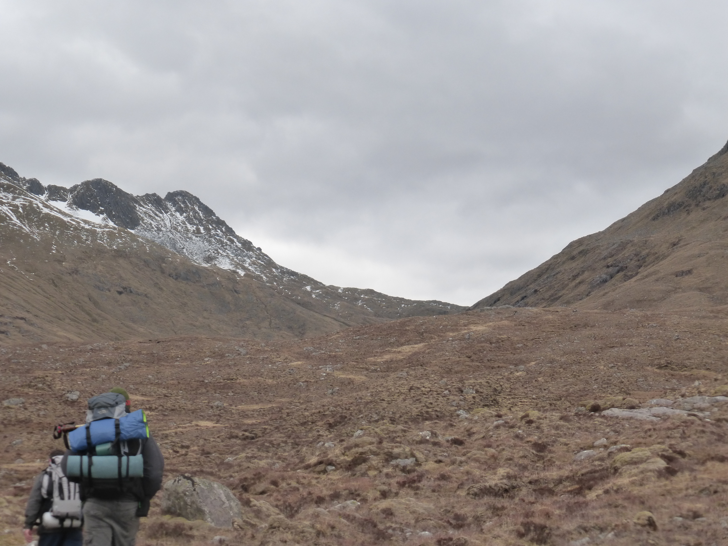
Looking down Gleann Cuirnean towards Strathan
Kenny, Alan and the girls march on towards Strathan

Our plunge pool and lunch spot at the River Pean

Follow the leader - the team make their way towards the path which descends steeply into Loch Nevis
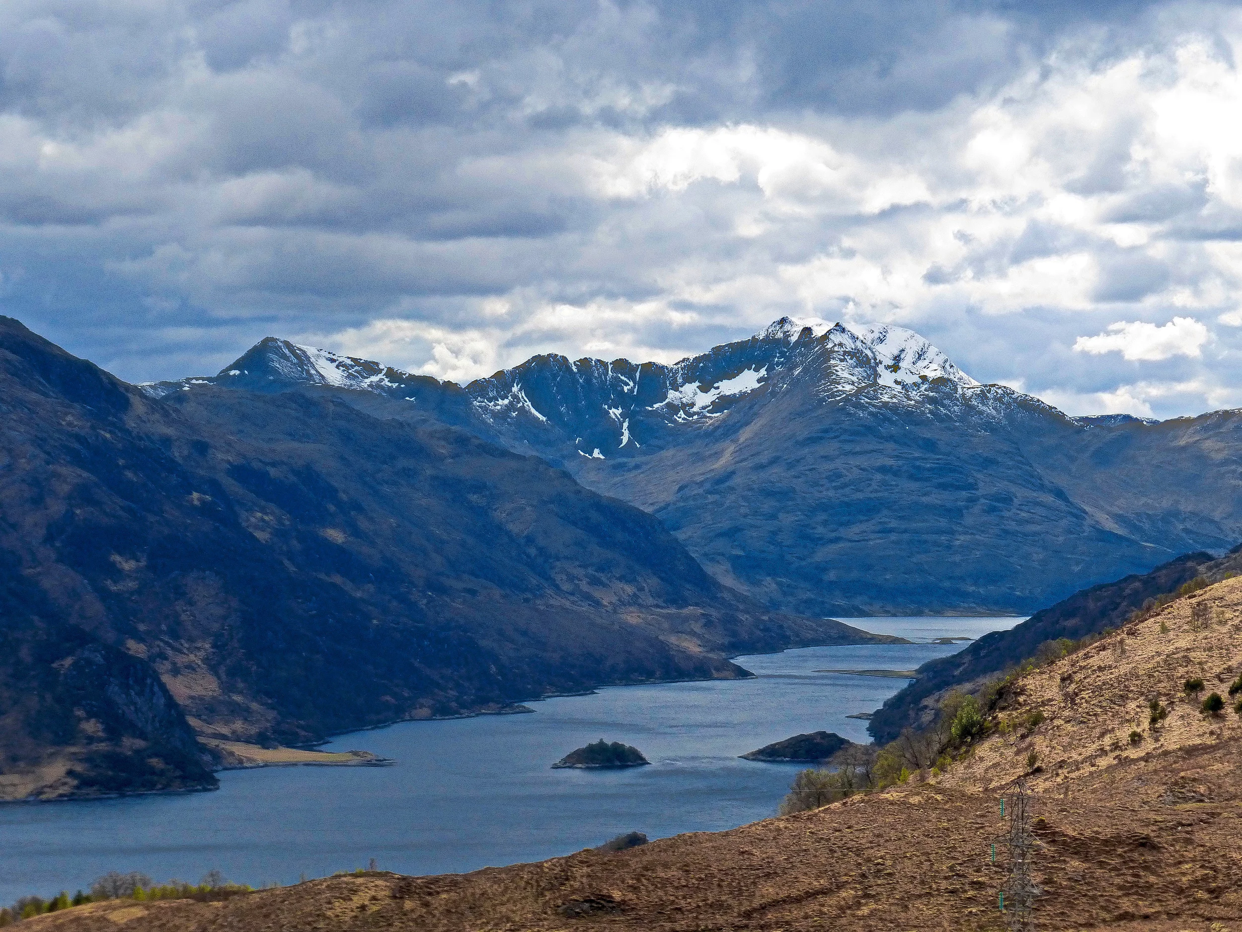
Loch Nevis. You can just about make out the very popular Sourlies bothy
Gary is the first to cross the dodgy bridge over the River Carnoch
Day 2 - River Carnoch to Shiel Bridge, 21.5 miles 1,930 metres climb
Camp was a very quiet place that night. Day one had been a real eye opener for the team and there were some very heavy legged hikers by the end of the day. It was important that everyone got a good nights sleep as day two would be twice as hard and even more energy sapping.
After a good sleep, I was first at to surafce just after 6am. I was conscious of the need to get up and away as early as possible as we would need all available daylight if we were going to stand any chance of reaching Shiel Bridge before dark. Ellie soon appeared from the confines of her tent and I soon realised that her sleep wasn't quite as successful as mine. Having just announced to Alan that I probably had my best ever sleep in a tent, Ellie added, in a flood of tears, that she just had the most miserable night of her life. Freezing cold, wet and with no sleep whatsoever, she definitely wasn't up for 'high-fiving' the experience. One by one, the team gradually emerged from their own little canvas worlds into what was actually a glorious morning. At 7am, with the sun hiding behind the mountains, it was bitterly cold, but the mood within the camp was actually very positive and upbeat - if only they knew what was come!!
The first section was to follow the River Carnoch upstream into the heart of the Knoydart. It was a lovely start to the day and a beautiful walk deep into the gorge. The views of Knoydart were ever more awesome as we turned each corner; the morning sun shimmered on the grass laden mountain slopes, awash with purple heather, little groups of trees and pockets of snow - it was truly stunning. The rising sun splayed elongated shadows across the rocks and boulders which clung to the hillside, adding that little bit of drama to the landscape.
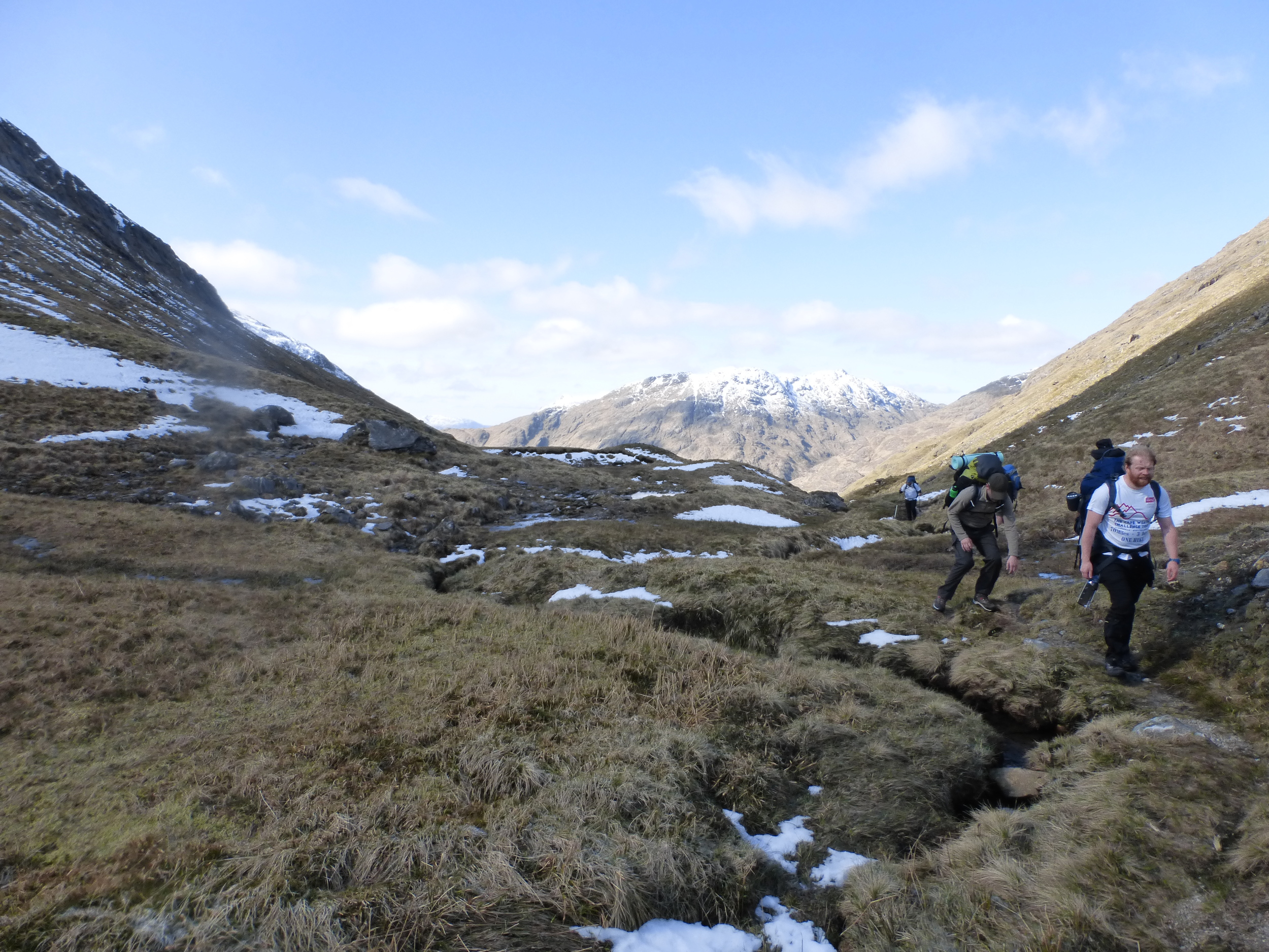
Before long, it was time to leave the riverside and head directly up the hillside to the mountain path which led to Barisdale and Loch Hourn. I recalled from my previous time on the trail that this was a hazardous climb, fraught with the possibiilty of slipping to the bottom with one false move. Etched in my mind were memories of scrambling up an almost vertical face, clinging for dear life onto little tufts of grass and heather, desperate not to fall back down to the River Carnoch below. My concerns were allevaited somewhat as the climb, this time, was nowhere near as bad - although it was still a tricky and steep scramble. A few of the guys made the first attempt while I waited back for the others. It would be unnecessary waste of energy by storming up the hill; slow and sure was the name of the game and half an hour later we had all made it and reached the path high on the mountain. The views up here were astonishing - you'll be hard pushed to find anywhere more picturesque in the whole of Scotland. We were in the middle of Knoydart, the sun was shining, skies were blue and the mountains were spectacular. This view was my highlight of the three day challenge.
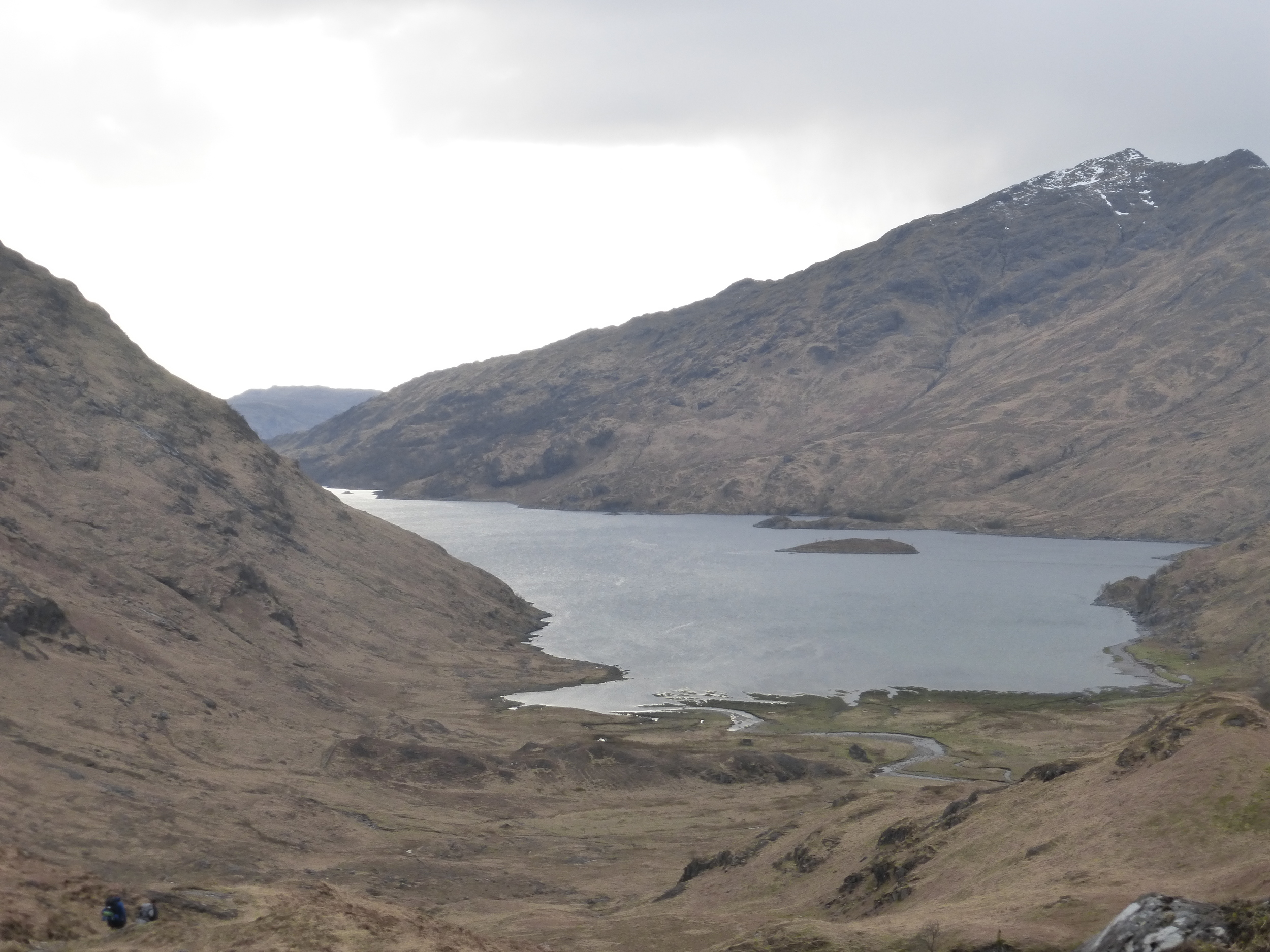
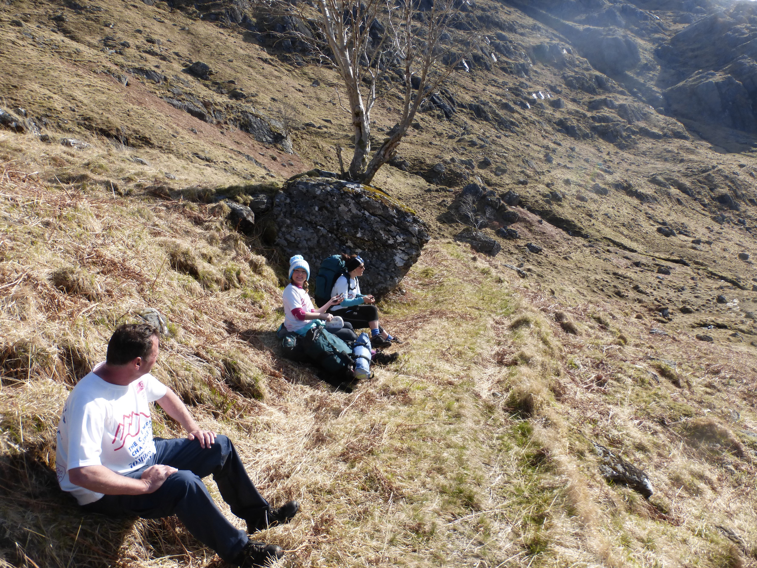
Re-grouped, we continued along the narrow hillside path, climbing gradually to the 500 metre high mountain pass, before leaving behind those wonderful views surrounding Loch Nevis and Loch Quioch. One stunning view was soon met by another wonderful horizon, this time of Loch Hourn and the distant mountains of Loch Alsh and Skye. The descent to Barisdale was steady and gradual, following the glen to the shores of Loch Hourn. The group, by this stage, had separated considerably. At the bottom the hill, the leaders waited at a wooden bridge for about half an hour for the others to catch up. I was now having real concerns over our pace as a group - it had taken a lot longer than I thought to complete this section and, at this rate, we would never make Shiel Bridge before dark. It was time to get serious. After a discussion with the team, Kenny F, Chris and Ollie decided that they would walk to Kinloch Hourn and make arrangements to for a taxi to take them the rest of the way to Shiel Bridge. It was a really tough and emotional moment. The guys desparately wanted to continue with the rest of us, but with a combination of niggling injuries and fatigue, they were completely selfless in allowing the rest of us to continue at a pace which would get us to Shiel Bridge before dark. We said our goodbyes, shared a few hugs and we were on our way. Two minutes later and unbeknown to Kenny, Chris & Ollie, Gary decided it would be a good idea to open a can of John Smith's for the walk through Barisdale. I shudder to think of their reaction if they knew Gaz had opened a beer through their moment of pain (of couse I had to have a sip for medicinal purposes).
The six mile path along the loch was an enjoyable walk, although unexpectedly tiring with a few steep climbs that you don't really see on the map. By the time we reached Kinloch Hourn, it was nearly 3pm and the legs were beginning to feel weary - not great considering the toughest leg of the entire challenge was waiting for us around the corner. We needed a break to recharge the batteries, after which we would have five hours of daylight to climb 700 metres over 9 miles. This was a mini challenge all in itself and to make matters worse, the weather was beginning to take a turn for the worst - the sun had gone for the day and the wind was really picking up. Just as we were about to leave, Alan dropped the bombshell that he was stopping here for the day and would wait for the guys behind. I don't think he was even quite sure why he was stopping, it just felt like the right thing to do at the time.
In all honesty, I was really worried as we set off for the trek to Shiel Bridge. While researching the trail, I was expecting one or two potentially tricky river crossings and a long pathless section up the south side of the bealach to Forcan Ridge, which would take us to our highest point at 700 metres. There was also the fact that we had left four of the team a few miles back - I had to assume that they would make it safely to Shiel Bridge - somehow!! I decided there was no choice but to shorten this section ever so slightly by leaving the mountain down to the road a couple of miles before Shiel Bridge rather than take the rough, time consuming path through the glen from Forcan Ridge into Shiel Bridge. Our back up driver, the ever reliable Steve Turner, who was traveling up from Dundee, was alerted to the slight change of plan - hopefully he got the voice message and would be there to pick us up at the layby on the main road.
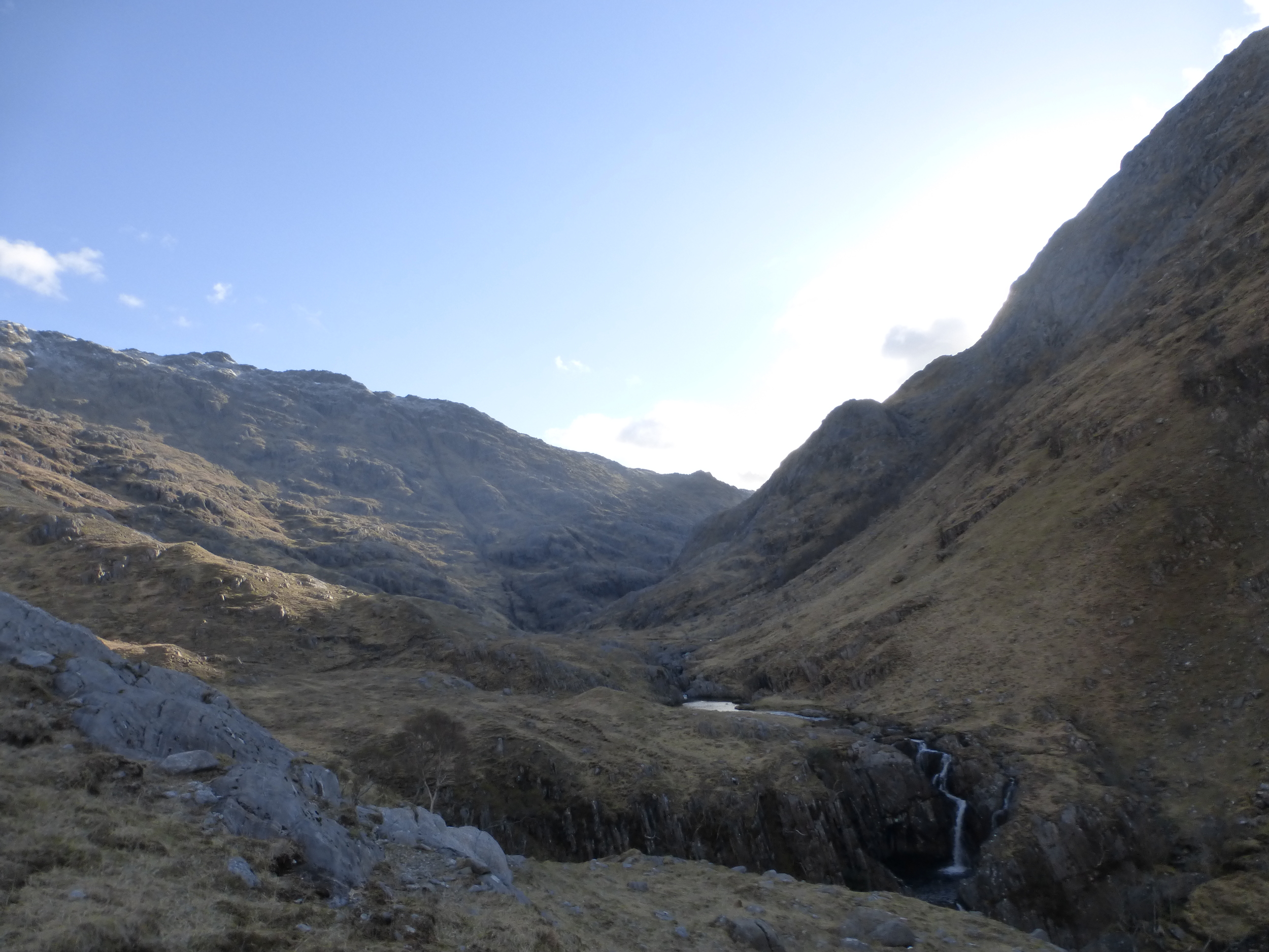
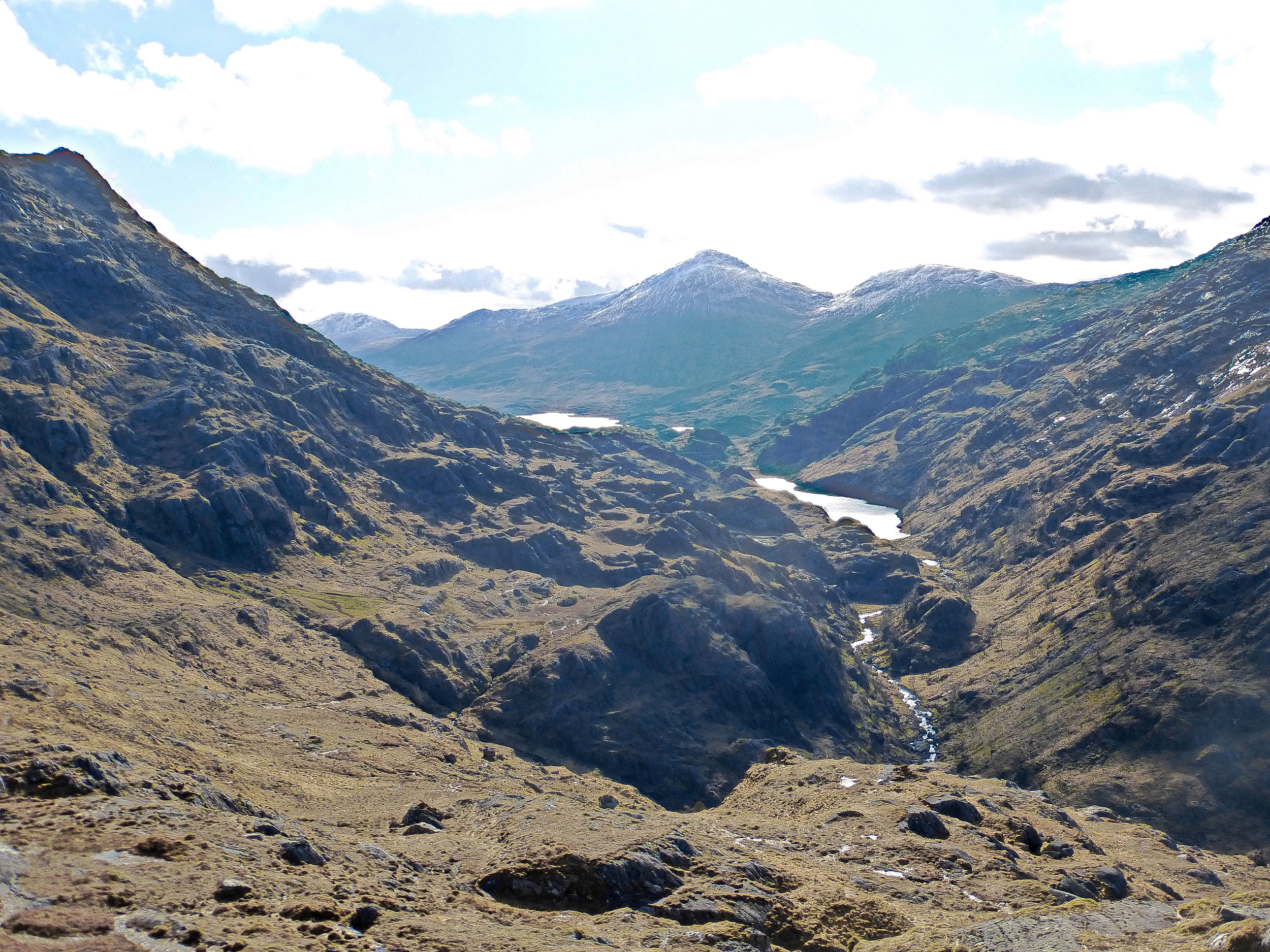
The climb out of Kinloch Hourn was quite severe, which wasn't helped by the makeshift, eyesore of a track recently created to aide the construction of an overhead electrical power line (which apparently plugs Skye into the grid). Although tough going, we were making good progress becoming more confident of making it to Shiel Bridge by 20:30. The rivers weren't in spate which made for easy crossings and, at the point where we traversed the south west shoulder of Sgurr Na Sgine's lower slopes, we reached the end of the track, the team was fairly upbeat. I pointed out the bealach that we were heading to and, although the snow covered peak of The Saddle looked slightly intimidating, the fact we were just going up and over the lowest point of the mountain pass didn't look too bad - oh how these hills can be deceiving!! The nextninety minutes were probably some of the most exhausting we had ever experienced. The slopes was becoming steeper with every step, the ground underfoot was becoming increasingly treacherous and the top of the pass seemed completely unreachable. As we edged closer to the head of the bealach, I could feel the wind getting stronger and the chill factor was much more intense. We had reached the snow level, sitting at around 550 metres, although thankfully it wasn't affecting our climb. I led from the front, trying to find the safest way up the hill. A number of mini gorges and fissures in the rock were making the route that much more difficult. There was a great deal of zig zagging across little streams and between boulders, where we would pause for a drink and a few Wine Gums before setting off again. We could hardly go more than ten metres before having to take a break - it was so exhausting. After what seemed like a lifetime, I reached top of the bealach first. I didn't really know what to expect up there but the extremity of wind and the sheer volume of snow made it very unnerving. The wind was storm force by now, as it funneled between the towering Munros on either side and we felt extremely vulnerable. The guidebook points out a row of stones which mark the start of a path along the Forcan Ridge and ultimately off the mountain - but I couldn't see it anywhere. Snow was now the dominant factor and cause for concern, making it very difficult to navigate and I could tell that some of the little pockets were deep and likely to dislodge at any time. We had to avoid walking across any snow in case we fell right through it, while also leaning into the wind in order to stay upright. After a while, my eyes adjusted to the conditions and could just about make out the wall we were looking for. The only way to reach it was to climb another fifty metres around the edge of the snowline and descend sharply. It was a treacherous little section and, where I felt ok (even though I fell waist deep in a pool of icy water), I still felt responsible for the safey of five other people behind me; and that reality was beginning to prey on my mind. We'd already left four people behind - I shudder to think how we would have fared as a group if all ten of us had decided to tackle this section. Sometimes, when you're so exhausted, both mentally and physically, your emotions get the better of you and, as we were making the slow descent off the hill, I was reflecting on the day and felt the need to phone home to speak to Jenny and the kids. When she answered, all I could say was, 'hello' before I started bubbling away, explaining how hard the challenge was and that I had put the team through far too much.
The wind was still fierce as we reached lower altitude, in fact, it was getting stronger. I was now beginnning to think we would be in for a rough night if it was going to keep up like this. For the last few hours, the magnitude of this challenge really started to sink in. It had been a hugely tough day - more than I'd ever dare to tackle on a normal walking excursion. But, it was for charity and we had to make it difficult if we were to raise money for CLIC Sargent. We could see the road below from a long way up - which never helps. It took an age to get off the mountain, although remarkably we had reached the finish by my estimated time of 20:30 (ish), it was just a pity we had to get a lift for the final mile or so to the campsite - which leads to another story all in itself.........
Steve had received our message and was on hand to drive us along the road to camp - excellent. On our way along the road, I heard a bang but thought nothing more of it as the car seemed to be moving along ok, I thought nothing more of it. Coincidentally, the rest of the team arrived in a taxi from Kinloch Hourn at almost exactly the same time. I was very happy and so relieved to see them. They were in good spirits and made the walk to Kinloch Hourn ok. Unfortunately, all but Alan had decided their hiking exploits were over, for this challenge anyway. As for the camping, the efforts of the last few hours had really taken it's toll on some of the team, to the point where I wondered if anyone would be able to walk the following day. Whether it was a twist of fate or simply pure determination to find anywhere to sleep other than a tent; Donna, Ellie, Kenny, Alan & Steve found a static caravan to bunk in for the night - to them it was heaven and maybe what was needed to recharge the batteries for day three and the final push into Strathcarron. As they left for the caravan in Steve's car, we noticed he had a puncture - we couldn't believe it - even our back up car was knackered!!
The path upstream along the River Carnoch offered some beautiful views. Ahead lies the climb where we scramble up the hill to the path which leads to Barisdale
Simply stunning views across to Loch Cuaich
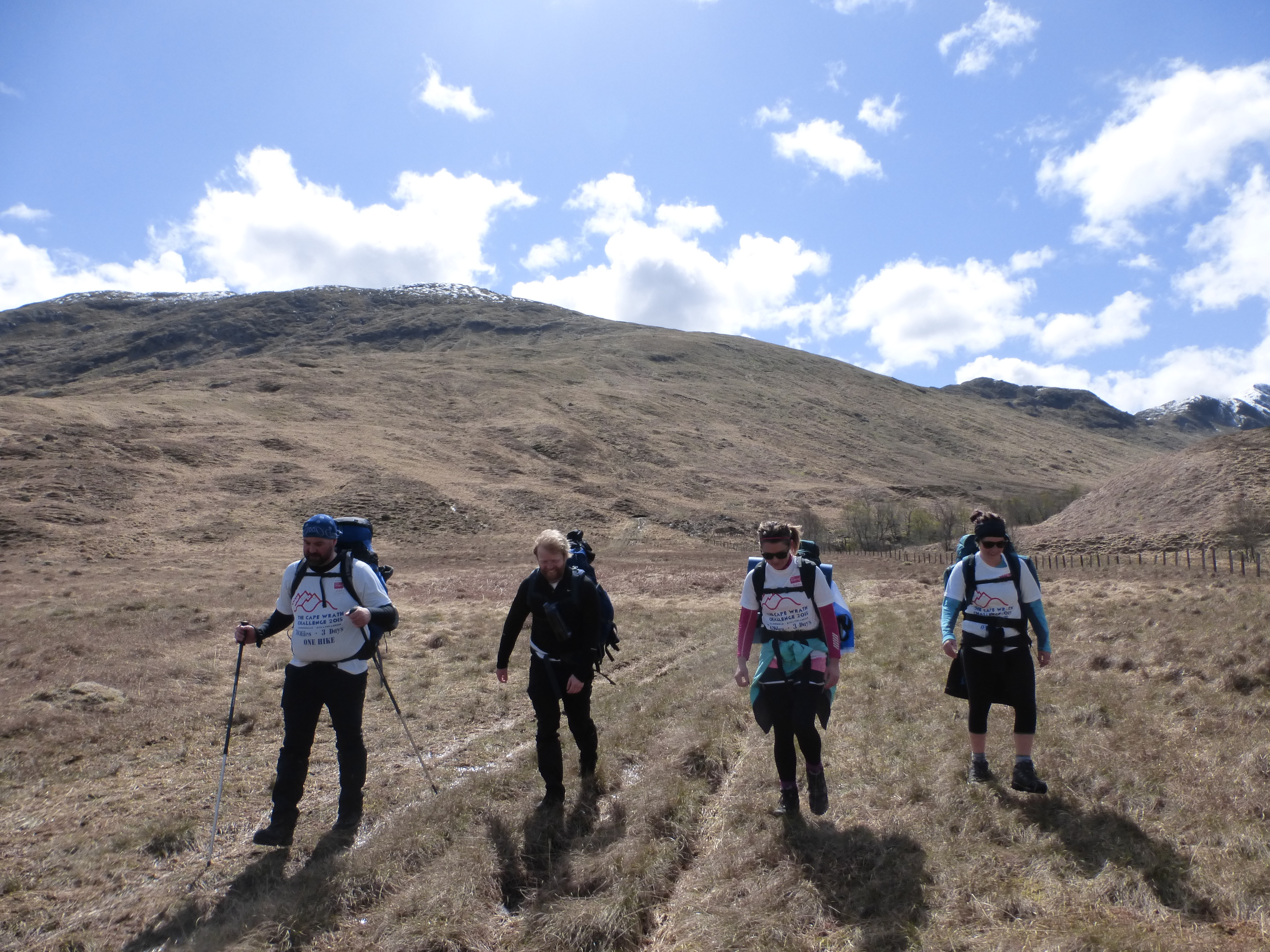
Niall, Donna & Ellie take a well earned rest after the climb from the River Carnoch

A look north down to Loch Hourn from Gleann Unndalain

Barisdale really is a beautiful location only accessible by boat and hardy hikers

Gary enjoying the view alongside Loch Hourn
A view of Loch Hourn looking South West. The Cape Wrath Trail follows the banks on the far side
The pathless climb to the bealach between The Saddle and Sgurr Na Sgine doesn't look too bad - until you actual climb it.
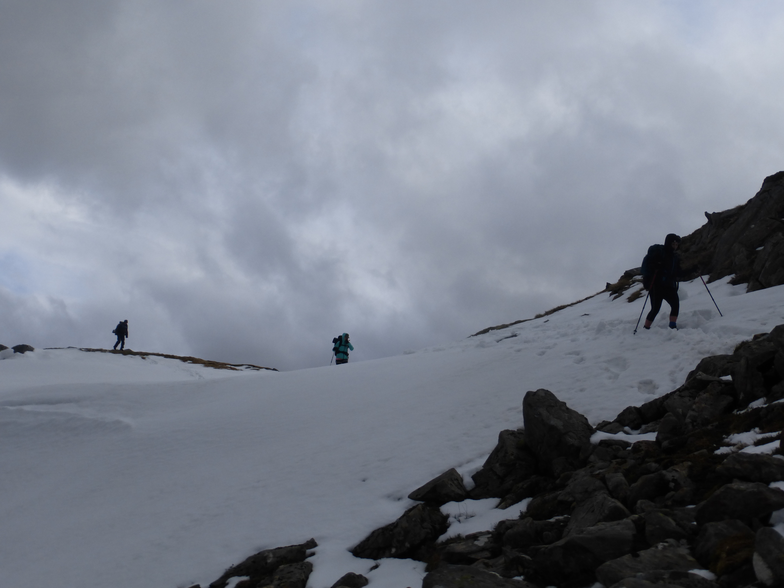
Things were a bit treacherous at Forcan Ridge until we found the path
Day 3 - Shiel Bridge to Strathcarron, 21.0 miles 1,163 metres climb
(actual distance hiked - 13.7 miles, 1,119 metres climb)
That night was wet and wild to say the least and I was surprised that our tents were still intact by morning. Other campers on site were not so fortunate; one couple were busy trying to rescue their outer sheet from a nearby field, while another family's tent collapsed on them during the night. The frame on my new tent had been reshaped by the gale force winds which pounded the campsite throughout the night. What was once a strong and rigid pole now resembled a wonky boomerang. I couldn't believe the wind had done this to the frame without managing to snap it. The windy conditions hadn't let up by morning and we had to decide on our plan of action. Could we make the full twenty one miles without being blown off our feet and off a cliff face? Steve's puncture limited our choices. It would be at least 08:30 before the car could be fixed - and we had originally planned to leave at 7am for a three mile road section through Shiel Bridge to the start of the next stage. Without this, we faced the prospect of this now being a twenty four mile day - simply not an option in these foul conditions.
We decided that it was too risky to attempt the full distance as we just didn't know how bad the weather would be at the highest point at 500 metres. Any snow, coupled with these winds, would have been a show stopper. The guys who stopped at Kinloch Hourn on day two had arranged for Steve to drive them back to Fort William, where they would make the onward journey home. We were now a team of seven, which I was delighted with given the condition of everyone after the exertions of the previous day. We managed to find a local taxi who agreed to take us from Shiel Bridge to Killilan, while Steve took the others to FW. It was a sore one to take as it meant cutting short the original seventy mile Challenge, but there really was no choice if we wanted reach Strathcarron in one piece and before dark. On paper, the final 13.7 mile leg didn't seem too bad. The terrain here was different to Knoydart - less intimidating, not as remote with more of a rolling landscape.
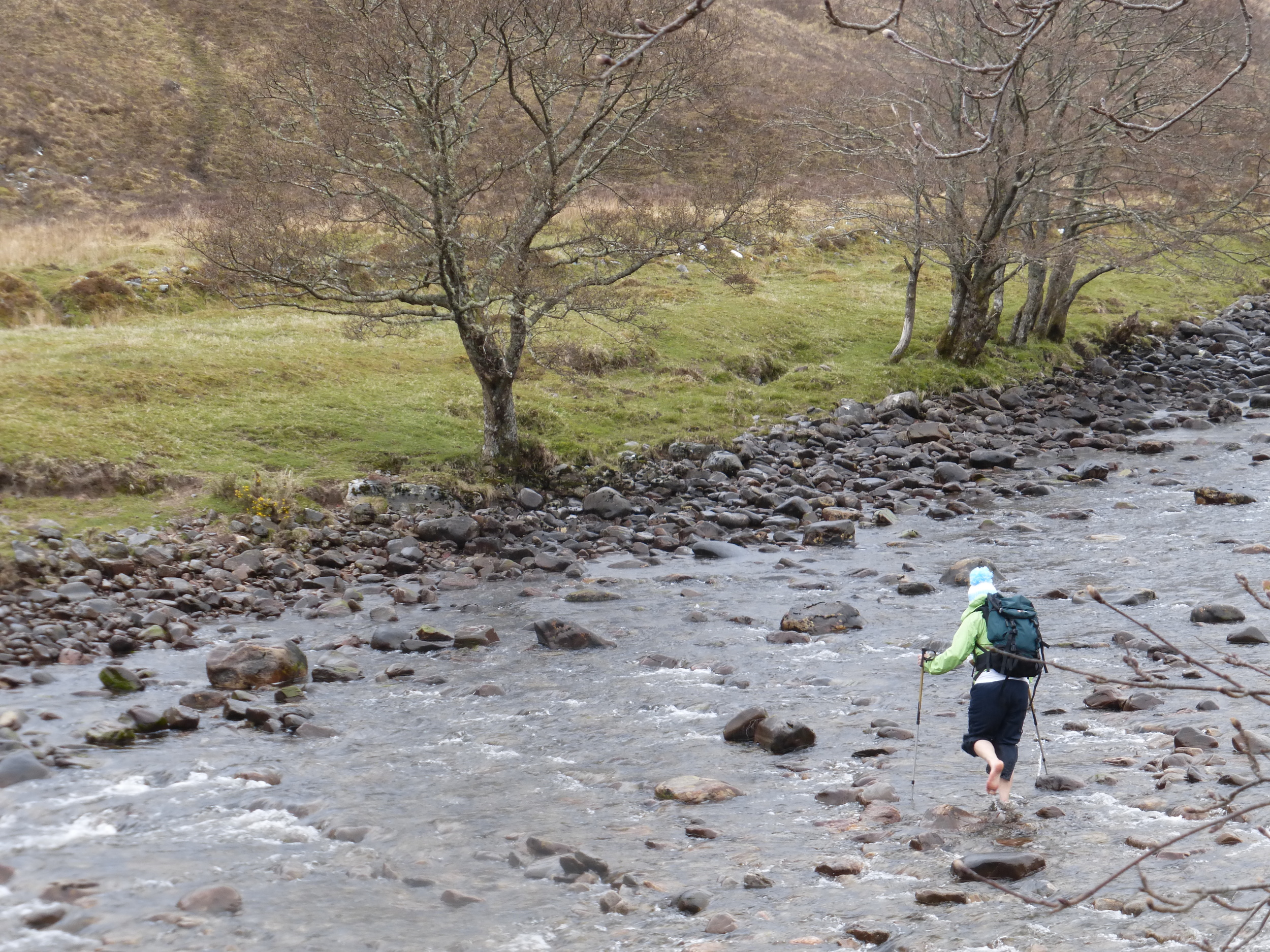
Despite the wind and rain, we set off in high spirits. The going underfoot good as we followed a well established stalkers track for the first couple miles. The first real challenge of the day was negotiating the River Ling. There was no bridge so it was a case of removing the socks and shoes and wading across the freezing cold waters. The river was around twenty metres or so wide, which was a fair old crossing. I had a pair of lovely bright white Crocs which were perfect for the occasion. Fair play to Ellie for going across in her bare feet - standing on so many jaggy rocks and stones couldn't have been pleasant.
The rain was becoming progressively heavier and more persistant and, once we found the next stalkers track up the hillside to Loch an Iasaich, the conditions were miserable. It was simply a case of hiding inside your waterproof, getting the head down and marching on as best we could. As we exited the forest and started the next climb, this time passing Loch an Droighinn and Loch na Caillich, the rain had started to ease and we were at least able to chat amongst ourselves again. The track ahead was clear and it appeared for a while that it may be like this all the way into Strathcarron. By now, I was having some real discomfort in my left foot. My feet (and Gary's for that matter) took a real pounding at the previous weeks Highlander Mountain Marathon, especially where we had to run across a never ending boulder field near Inchnadamph in Sutherland. The few days inbetween the two events just weren't enough for my foot to recover and it was quite painful by lunchtime. I was desperate to get off the stalkers path and onto the hillside, where the softer impact of the sodden heather and long grass would have provided some welcome respite from this hard 4x4 track. The other guys didn't seem to mind, emphasised by the fact that they were motoring well ahead. What they seemed to forget, however, was that I had the map and was aware of a point where we had to leave the track onto the hillside and follow an old ruined fence which would lead us over the crest of the hill and to the hotel. By the time I had worked out exactly where this was, Niall and Kenny had walked so far on that they were out of ear shot. Five minutes later, after a bit of running and shouting down the line, we were all together again. The map suggested there was a path to follow but in reality, there was nothing but the distant bealach, which would be our final climb of the challenge. The ascent was much less daunting than it looked and we made the climb in good time, albeit through thick heather and boggy marshland. Close to the top of the hill, the path eventually presented itself and it was from here I could relax in the knowledge that all we had to do now was follow this off the hill and into Strathcarron. My navigational responsibilities were over and it was a great sense of relief to have led the team from Glenfinnan across all sorts of highland terrain without getting lost.
After that final climb, I made the mistake of saying, '...it won't be long now', thinking Strathcarron was just around the corner. It seemed like a never ending descent and the team, particularly the girls, were getting agitated. The rain was back on and, for the first time, I was feeling cold. Although my waterproof jacket was holding up well against the elements, my gloves were soaked through as well as the cosy Thinsulate's. We could now see the village in the distance and light was at the end of the tunnel. Eventually, at about 3:30pm, we dragged our soaking, bedraggled and completely exhausted souls across the finish line and into the indescribable comforts of the hotel. No fanfare or hoards of people there to welcome us - but that didn't matter. We had completed the Cape Wrath Challenge and it felt amazing. Yes there was more than a fair share of blood, sweat, tears and cursing along way but it was a truly wonderful adventure and an unforgetable experience. New friendships were forged and existing ones strengthened - we had a fantastic group of guys and, for what they had to endure over the three days, there was never a word of complaint from anyone (not out loud anyway) and I thoroughly respect their determination to overcome every challenge which came their way.
The Cape Wrath Challenge was a success on so many levels; we'd made it from Glenfinnan to Strathcarron in one piece and many personal goals were achieved. One of the main goals from the challenge was to raise money for charity and, as successfull as this was (nearly £3,000 for CLIC Sargent), the biggest success for me was giving ordinary people the opportunity leave the rat race of daily life to experieince Scotland at it's finest, while conquering Britains toughest trail and seeing the joy in their faces when we reached Strathcarron. We live in a truly beautiful country and this experience will last with me and the team for many years to come.
Total Distance hiked: 60.2 miles
Total Climb: 4,357 metres
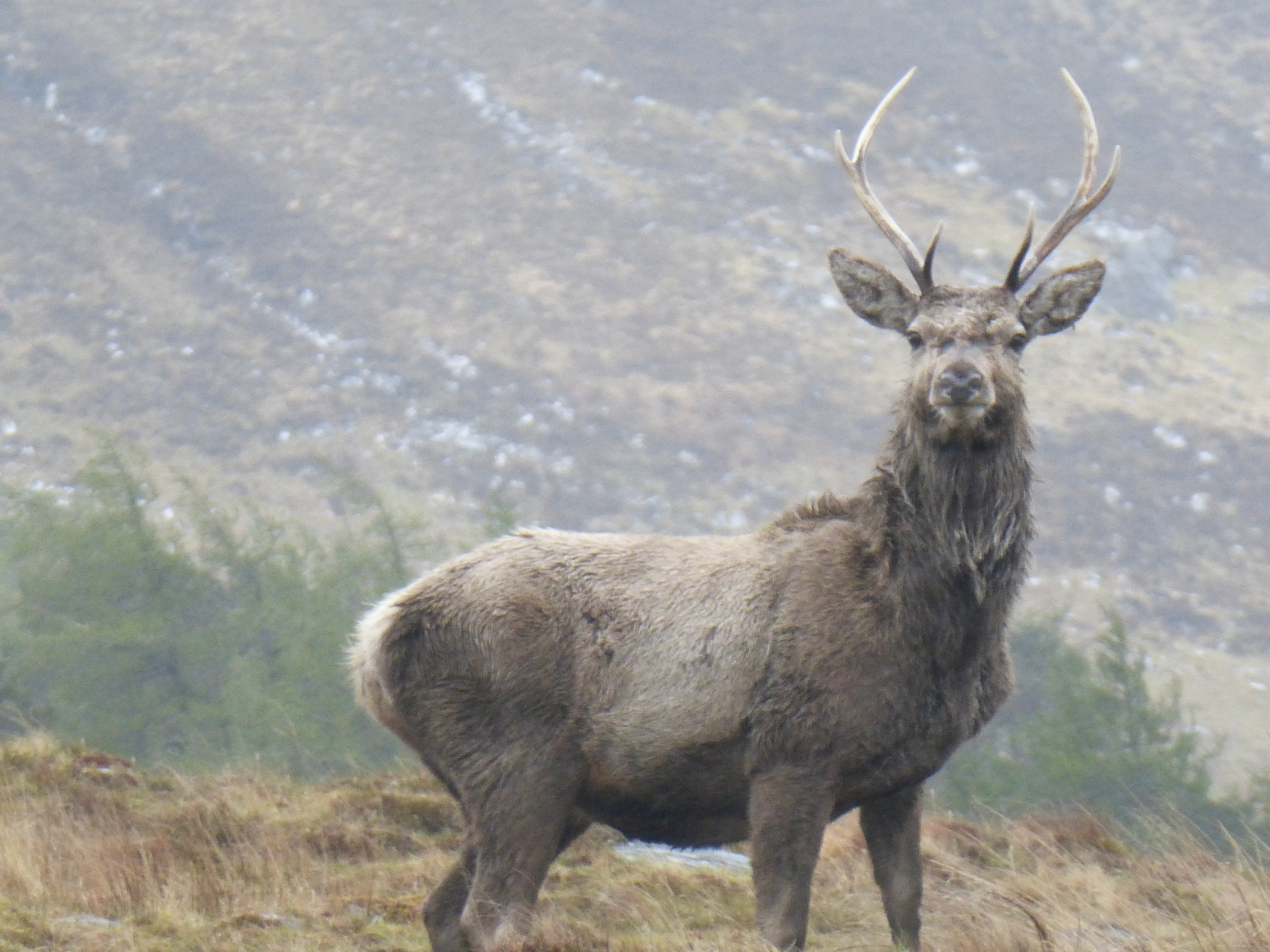
Just after leaving Killilan we were met by a herd of deer, who didn't seem bothered about our presence in the slightest
Ellie braves the freezing cold water as she crosses the River Ling
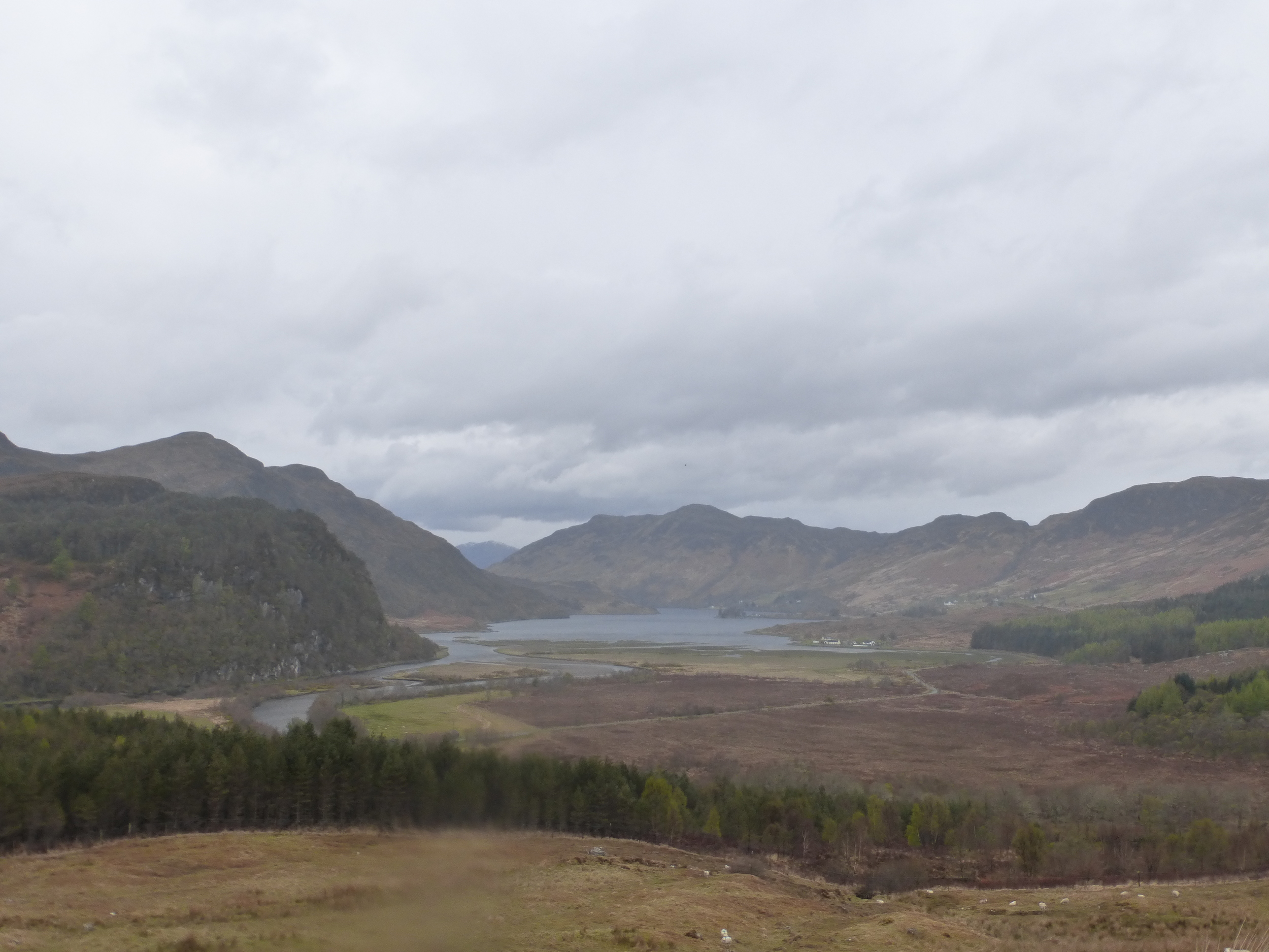
One of the few good views on Day 3. This is the head of Loch Long near to Killilan
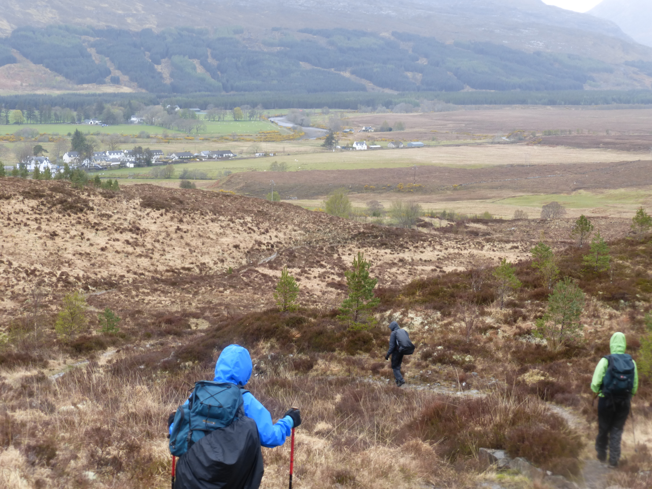
Nearly there. The team edges closer to Strathcarron in the distance

We made it and still smiling (Niall's taking the picture)
