

The West Highland Way
| FEATURES: | ||
| Distance: 96 Miles / 154 Km | Season: April to October | |
| Start: Milngavie | Min Group Size: 1 | |
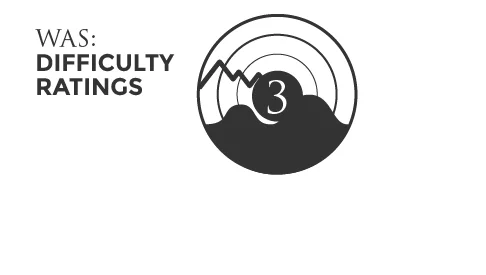
| Finish: Fort William | Difficulty Rating: 3 | |
“A truly great trail winds into the essence of a place, so when assembling this list of the world’s great hikes we kept an eye on more than the footpath. We looked for walks that travel deeper into a location’s history and culture. Sure, there’s outdoor adventure on each of these 20 hikes, but the trails also tell a rich story. So here they are, the holy grails of trails across the world. - Doug Schnitzspahn”
“I am one very satisfied customer who would arrange another trekking holiday with WAS without reservations. Ross, I can’t think of anything else you could have done in such short notice in putting together my trip. Thanks!”
Overview
The West Highland Way is arguably the most famous walking route in Scotland. Steeped in history, this wonderful long distance path takes you north, from the bustling commuter town of Milngavie (pronounced mul-guy), to the Highland tourist hub of Fort William, nestled in the shadow of Britain’s highest mountain, Ben Nevis (1,344 metres).
From the rolling East Dunbartonshire countryside and the waterside paths of Loch Lomond, to the remote, wide open spaces of Rannoch Moor and the stunning mountain range of Glencoe; the variety of landscapes along the way makes this one of Scotland’s premier walking routes.
The route is very well signposted, with well-maintained paths and tracks throughout. Accommodation, services and refreshments are also strategically located from start to finish, providing opportunities for a comfortable and relaxing end to a tough day’s walking.
The Route
STAGE 1: MILNGAVIE TO DRYMEN
DISTANCE: 12.5 MILES / 19.5 KM
HIGHEST POINT: 140 METRES
The walk starts at the obelisk in the Milngavie town centre and follows the Allander Water through patches of woodland, before heading into Mugdock Country Park and Craigallian Loch. The rolling hills and countryside of the Campsie Fells soon come into view, with the mountains of the Highlands on the distant horizon. The route towards Drymen follows a quaint, hedge lined country lane, before leaving the WHW down into the village of Drymen.
Additional info: There is a 0.5 mile walk from the WHW into Drymen.
STAGE 2: DRYMEN TO BALMAHA
DISTANCE: 7.5 MILES / 12KM
HIGHEST POINT: 315 METRES
Back on the WHW after a slight detour into Drymen, the route soon enters the Garadhban Forest, where there are two options for walkers; the first being an easier walk into Milton of Buchanan, where the road is followed into Balmaha, sitting on the banks of the loch. The second option is a more strenuous, but ultimately much more rewarding route, as the climb up Conic Hill gives rise to fabulous views over Loch Lomond.
Additional info: 6 miles via Milton of Buchanan
STAGE 3: BALMAHA TO ROWARDENNAN
DISTANCE: 7.5 MILES / 12 KM
HIGHEST POINT: 90 METRES
From Balmaha, the route starts its 21 mile section along the east side of Loch Lomond, flirting with the water’s edge along much of the way. This is a lovely, low level and relaxed stage as it meanders through pebble beaches, caravan & camping sites and beauty spots throughout. Reaching Rowardennan marks the spot where many walkers choose to climb Scotland’s most southerly Munro, Ben Lomond.
STAGE 4: ROWARDENNAN TO INVERSNAID
DISTANCE: 7 MILES / 11.2 KM
HIGHEST POINT: 131 METRES
From Rowardennan, the path heads into thick woodland, where the way is quiet, peaceful and remote. There are two options here; the easier being the wide forest track which follows the contours up and down the hill; or the more time consuming, narrow path which skirts over rocks and exposed tree roots long the banks of the loch.
Additional Info: Alternative route along banks of loch
STAGE 5: INVERSNAID - INVERARNAN
DISTANCE: 6.5 MILES / 10.4 KM
HIGHEST POINT: 103 METRES
Similar to the low level section on the approach to Inversnaid, the rocky and uneven path continues along the loch, hugging the water’s edge amidst the fabulous and ancient oak forest. The loch becomes noticeably narrower as the path approaches Inverarnan. The forest eventually clears, exposing a more open stretch of countryside, which descends down the hill into the Beinglas Farm Campsite at Inverarnan.
STAGE 6: INVERARNAN TO CRIANLARICH
DISTANCE: 6 miles/10km
HIGHEST POINT: 250 METRES
Soon after leaving Inverarnan, the path runs alongside the picturesque, fast flowing River Falloch before a long stretch on an old military road. The route here closely follows the west highland railway and eventually passes underneath the tracks as the path nears a coniferous forest. The path splits here, with the option of continuing along the WHW towards Tyndrum or taking a half mile detour into Crianlarich.
Additional Info: 0.5mile walk into Crianlarich
STAGE 7: CRIANLARICH TO TYNDRUM
DISTANCE: 6 MILES / 10 KM
HIGHEST POINT: 335 metres
The route continues through the forest, with the path winding and undulating through the contours, albeit not too far from the main road. The path crosses through the road and the River Fillin once or twice en-route to Tyndrum. The views from the valley are wonderful, with an almost 360 degree, panoramic view of the surrounding mountains. A well maintained path follows the River Cononish before reaching Tyndrum.
STAGE 8: TYNDRUM TO BRIDGE OF ORCHY
DISTANCE: 7 MILES / 11.2 KM
HIGHEST POINT: 330 METRES
From Tyndrum, the route closely follows the railway and the road, although continues to maintain its own unique qualities. By this stage, you are firmly in the Scottish Highlands and the view will be spectacular from here, all the way to Fort William. The path uses an old military road throughout this stage (and continues right across Rannoch Moor). This is also the most exposed section of the route so far with little protection from the elements.
Additional Info: 2.3 miles further to Inveroran Hotel
STAGE 9: BRIDGE OF ORCHY TO KINGS HOUSE HOTEL
DISTANCE: 12 MILES / 19.3 KM
HIGHEST POINT: 450 METRES
One of the more challenging stages of the WHW, the path climbs out of Bridge of Orchy through a coniferous forest, eventually providing lovely views across to Loch Tulla. The path then passes the Inveroran Hotel, before the long stretch across the edge of the wild and eerily remote Rannoch Moor, passed the Glencoe Ski Centre and into the fabulous mountain range of Glencoe and the isolated Kings House Hotel.
STAGE 10: KINGS HOUSE HOTEL TO KINLOCHLEVEN
DISTANCE: 9 MILES / 14.2 KM
HIGHEST POINT: 550 METRES
This stage of the West Highland Way includes the infamous Devil’s Staircase, the steepest climb of the route, reaching the highest point of the entire 96 mile journey (made easier by the zig zag path up the hill). The views from the top are spectacular. The track away from the staircase towards Kinlochleven signals an escape from the Glencoe Mountains and offers a long descent along excellent tracks all the way into the town.
STAGE 11: KINLOCHLEVEN TO FORT WILLIAM
DISTANCE: 15 MILES / 24.2 KM
HIGHEST POINT: 330 METRES
The climb out of Kinlochleven is a steep ascent through a beautiful little forest. The view from the top provides fabulous view down to Loch Leven and the village. The old military road then passes through a wide valley on the edge of Mamore mountain range, known as Lairigmor, before turning towards Glen Nevis through a variety of forested areas. The path gradually descends as the way approaches Fort William, with a final stretch along the road into Fort William centre.
Additional Info: Finish at Gordon Square
PRICES & ITINERARIES
| Tour Code | Duration | Ave. Miles Per Day | Prices From |
| WHW1 | 5 Days/6 nights | 19.2 | £710pp |
| WHW2 | 6 Days/7 nights | 16 | £785pp |
| WHW3 | 7 Days/8 nights | 13.7 | £860pp |
| WHW4 | 8 Days/9 nights | 12 | £915pp |
What is Included?
Pre-booked Accommodation
Breakfast each morning
Door to Door Baggage Transfers
Daily Itineraries
Maps & Guidebooks
Info on transport and local services
What is not included?
Evening meals & packed lunches
Travel to Milngavie
Travel from Fort William
Travel Insurance
Additional Info:
**Prices are based on 2 people sharing a twin or double room.
For itineraries which feature a stop at Kingshouse, there is the option to stay at the Kingshouse Hotel or we can arrange a transfer to the villages of Glencoe and Ballachullish. The car journey through Glencoe takes you through the heart of this stunning mountain range, offering wonderful close up views of the towering mountains which dominate the surrounding landscape.
Please note an additional ‘single supplement’ or 'single occupancy' charge will be incurred for solo walkers or for individuals who require single room accommodation. Typical rates vary from £25-£40 per night. The total single supplement is calculated on a case-by-case basis, subject to availability.
The West Highland Way hosts a variety of accommodation types; from budget stays including hostels, bunkhouses and wigwams to standard and more expensive bed & breakfasts, guest houses and hotels (please note that some budget accommodation may not include breakfast). Individual preferences can be stipulated in the Holiday Booking Form.
This package includes a one night stay in Fort William, however, additional nights at the end of the walk can be arranged to explore the highlands at your leisure, including a climb up Scotland's highest mountain, Ben Nevis. Walkers must organise their own return transport to Glasgow and beyond. Details of public transport services are available on request.
If you would prefer to walk the West Highland Way using an alternative itinerary, please let us know using the Enquiry Form and we will do our utmost to tailor the holiday to your needs.
Luggage Transfer Services - At WAS, we are delighted to include the reliable and professional services of Baggage Freedom and Ginger Routes. Please click on each link for further details of our luggage partners.
| WHW1 | ITINERARY (5 DAYS/6 NIGHTS) | DISTANCE |
| Arrival | Overnight Milngavie | |
| Day 1 | Milngavie to Balmaha | 18.50 miles / 32.80 km |
| Day 2 | Balmaha to Inverarnan | 21.50 miles / 35.00 km |
| Day 3 | Inverarnan to Bridge of Orchy | 21.00 miles / 34.00 km |
| Day 4 | Bridge of Orchy to Kinlochleven | 21.00 miles / 34.00 km |
| Day 6 | Kinlochleven to Fort William | 14.00 miles / 22.00 km |
| WHW3 | ITINERARY (7 DAYS/8 NIGHTS) | DISTANCE |
| Arrival | Overnight Milngavie | |
| Day 1 | Milngavie to Drymen | 12.50 miles / 20.00 km |
| Day 2 | Drymen to Rowardennan | 14.00 miles / 22.00 km |
| Day 3 | Rowardennan to Inverarnan | 15.00 miles / 24.00 km |
| Day 4 | Inverarnan to Tyndrum | 12.50 miles / 20.00 km |
| Day 5 | Tyndrum to Kingshouse | 19.00 miles / 30.50 km |
| Day 6 | Kingshouse to Kinlochleven | 9.00 miles / 14.40 km |
| Day 7 | Kinlochleven to Fort William | 14.00 miles / 22.00 km |
| WHW2 | ITINERARY (6 DAYS/7 NIGHTS) | DISTANCE |
| Arrival | Overnight Milngavie | |
| Day 1 | Milngavie to Drymen | 12.50 miles / 20.00 km |
| Day 2 | Drymen to Rowardennan | 14.00 miles / 22.00 km |
| Day 3 | Rowardennan to Crianlarich | 20.5 miles / 34 km |
| Day 4 | Crianlarich to Inveroran | 16.00 miles / 26.00 km |
| Day 5 | Inveroran to Kinlochleven | 19.00 miles / 31.00 km |
| Day 6 | Kinlochleven to Fort William | 14.00 miles / 22.00 km |
| WHW4 | ITINERARY (8 DAYS/9 NIGHTS) | DISTANCE |
| Arrival | Overnight Milngavie | |
| Day 1 | Milngavie to Drymen | 12.50 miles / 20.00 km |
| Day 2 | Drymen to Rowardennan | 14.00 miles / 22.00 km |
| Day 3 | Rowardennan to Inverarnan | 15.00 miles / 24.00 km |
| Day 4 | Inverarnan to Tyndrum | 12.50 miles / 20.00 km |
| Day 5 | Tyndrum to Inveroran | 9.00 miles / 14.40 km |
| Day 6 | Inveroran to Kings House Hotel | 10.00 miles / 16.10 km |
| Day 7 | Kings House Hotel to Kinlochleven | 9.00 miles / 14.40 km |
| Day 8 | Kinlochleven to Fort William | 14.00 miles / 22.00 km |
Extra Nights & Single Supplements
Many walkers decide to take rest days during the walking holiday, whether to give the feet a well-earned break, to do a little sight-seeing or perhaps a bit of ‘Munro-bagging’. If this option is of interest, please let us know on the booking form.
Additional nights can be arranged from £65 per person per night, subject to availability.
Please note an additional ‘single supplement’ or 'single occupancy' charge will be incurred for solo walkers or for individuals who require single room accommodation. Typical rates vary from £25-£40 per night. The total single supplement is calculated on a case-by-case basis, subject to availability.
Accommodation
Each Hotel and Bed & Breakfast has been hand-picked to ensure you enjoy the most welcoming, comfortable and value-for-money experience on this WHW route. A warm welcome awaits all walkers and hikers, with hotel owners keen to hear stories of the day’s adventures. Evening meals and packed lunches for the onward journey are available throughout, however, please note that they are NOT included in the holiday package.
Baggage Transfer
Each walker will be allowed one bag, of up to 20 kg in weight (although this may vary between individual providers), which will be transferred by dedicated baggage transfer operators. Your bags will be uplifted and dropped off between each place of accommodation.
Navigation
The route is well signposted throughout, however, walkers must be vigilant at all times as there are paths and junctions along the way which deviate from the main route. As well as the Guidebook, your package includes detailed map of the full route. WAS highly recommend that at least one member of your party is a competent map and compass reader.
Transport & Travel
Although travel to Glasgow, and from Fort William, is not included in the holiday package, we are more than happy to provide details of public transport services.
- To Glasgow – There are excellent air, train and bus services, allowing easy access from anywhere in the UK and overseas.
- To Milngavie – Public transport, by train, bus or taxi, from Glasgow city centre
- From Fort William – The main routes out of Fort William is by bus and train to Glasgow. The journey, whether by rail or coach, is an absolutely glorious trip with stunning scenery throughout. This really is the perfect way to end a memorable holiday.
Transport links will be detailed in your holiday package information pack.
Travel Insurance
WAS highly recommends that all walkers have suitable travel insurance.
Minimum Group Size
This route is suitable for solo walkers.
Dogs
Please contact us or email (info@walkacrossscotland.co.uk) if you would like to take your dog with you on the West Highland Way. Although limited, there are a growing number of hotels/B&B's who accommodate dogs .
Enjoying Scotland Responsibly
The Scottish Outdoor Access Code is a set of guidelines issued by The Scottish National Heritage Trust. The Scottish Outdoor Access Code provides detailed guidance on the responsibilities of those exercising access rights and of those managing land and water. By doing so, the Code provides a practical guide to helping everyone make informed decisions about what best to do in everyday situations.
The latest Outdoor Access guide can be viewed by clicking here