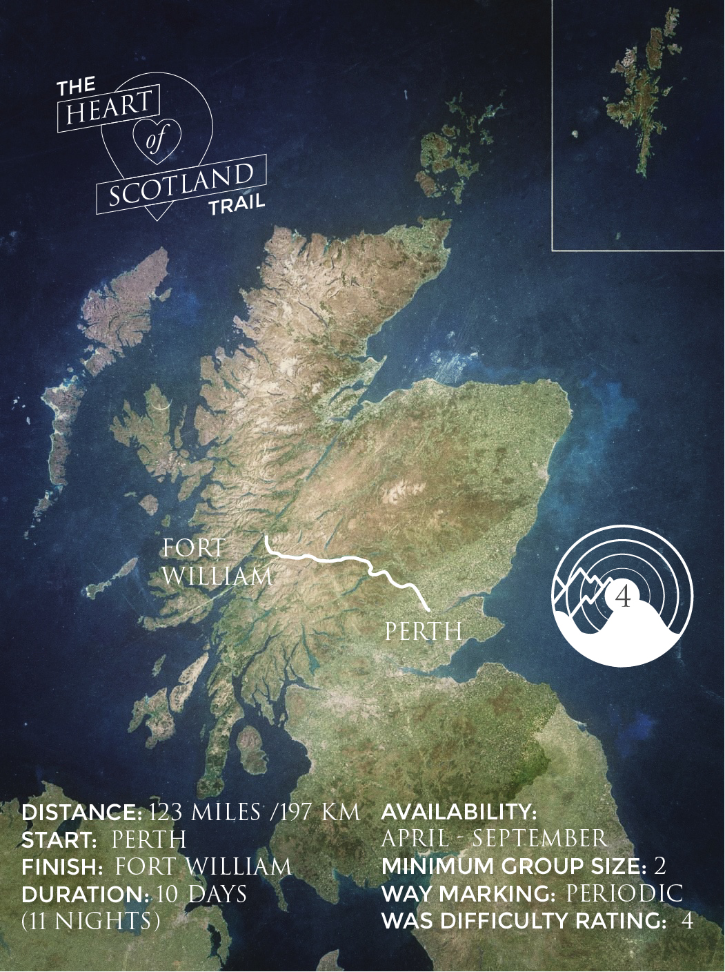
The Heart of Scotland Trail
Overview
The Heart of Scotland Trail is a delightful long distance walk, connecting east and west with a series of river walks, forest tracks, hill climbs and country lanes. Starting in Perth city centre, the route follows the River Tay upstream into the heart of the remote Perthshire hills and countryside as it meanders through the regions historic towns and villages. The trail then traverses the wilderness of Rannoch Moor towards the dramatic mountainous landscape of Glencoe and the famous West Highland Way, before arriving in Fort William under the shadow of Scotland’s highest mountain, Ben Nevis.
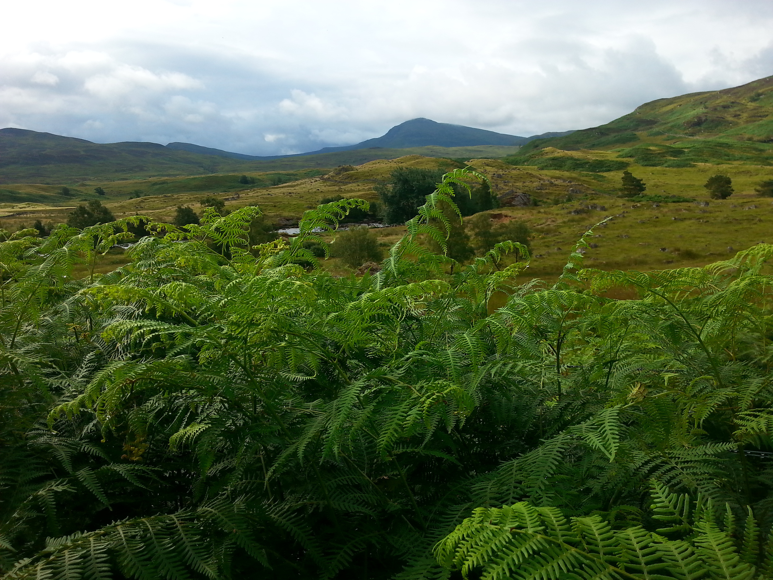
This 123 mile route boasts a stunning array of landscapes; from the gentle river banks of the Tay and the open hillside estate of Glenlyon, the stunning ancient woodlands of the Birks of Aberfeldy and Rannoch Forest, to the haunting peat bogs of Rannoch Moor; this is a walk which typifies the natural beauty of the Scottish Highlands.
Accommodation, services and refreshments are strategically located from start to finish, providing opportunities for a comfortable and relaxing end to a tough day’s walking.
EXCLUSIVE WAS GUIDEBOOK - We are delighted to include a detailed Guidebook within each Heart of Scotland Trail package - exclusive to WAS customers. Featuring Ordnance Survey map extracts and a step by step route description, this fully coloured guidebook will be sure to keep you on the right track (one per group booking).
Click here for a sample preview - Cover Page Route Guide
The Route
Stage 1: Perth to Luncarty
Distance: 6.0 miles / 9.80 km
Highest Point: 26 metres
The trail starts in Perth City Centre on the banks of the River Tay. A local cycle route takes you along the riverside path, away from the city and into the Perthshire countryside. This gentle walk is the perfect way to start your epic journey across the heart of Scotland.
Stage 2: Luncarty to Bankfoot
Distance: 6.50 miles / 10.20 km
Highest Point: 95 metres
From the village of Luncarty, the route follows heads through some rich farmland into the countryside, along an official national cycling route, before strolling into Bankfoot.
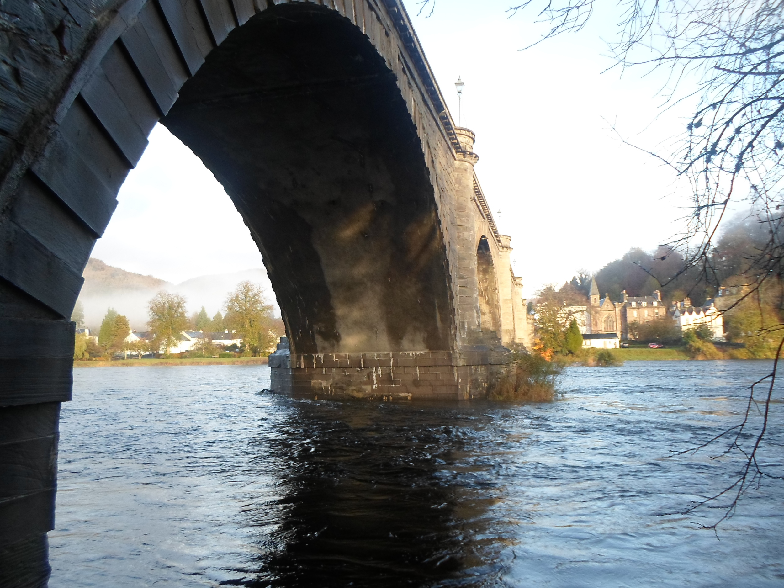
Stage 3: Bankfoot to Dunkeld
Distance: 9.50 miles / 15.20 km
Highest Point: 315 metres
The road from Bankfoot follows a country lane to Upper Obney farm, where the landscape suddenly changes from rolling farmland and countryside to jagged hillsides filled with bracken, heather and wild woodland. The pass across the Obney Hills is a wonderful introduction to the Highlands, with the beautiful views serving as a taster for the remainder of the walk. The path then weaves its way through the Tomgarrow Wood, along the Inchewan Burn and into Dunkeld & Birnam. This is a relatively short day’s walking but a wonderful route which will leave you desperate for more.
Stage 4: Dunkeld to Aberfeldy
Distance: 17 miles / 27.20 km
Highest Point: 90 metres
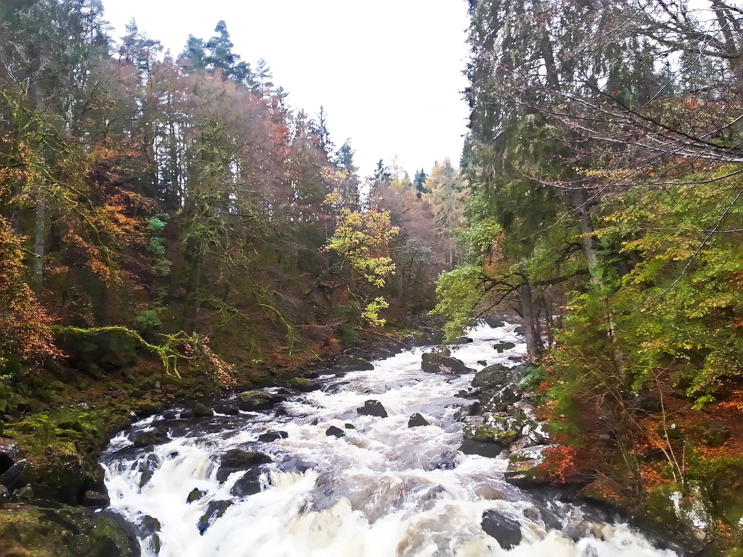
The route away from Dunkeld leads to The Hermitage, a wonderful collection of some of Scotland’s oldest and tallest trees. The Falls of Braan are as picturesque as anywhere in the country and remain one of Perthshire’s most popular tourist attractions. From here, the route heads into Craigvinean Forest, a largely dense woodland across the moor which follows forest roads into Aberfeldy. A carpet of purple heather along much of this route adds to the outstanding beauty of the area.
Stage 5: Aberfeldy to Kenmore
Distance: 8.5 miles / 13.60 km
Highest Point: 337 metres
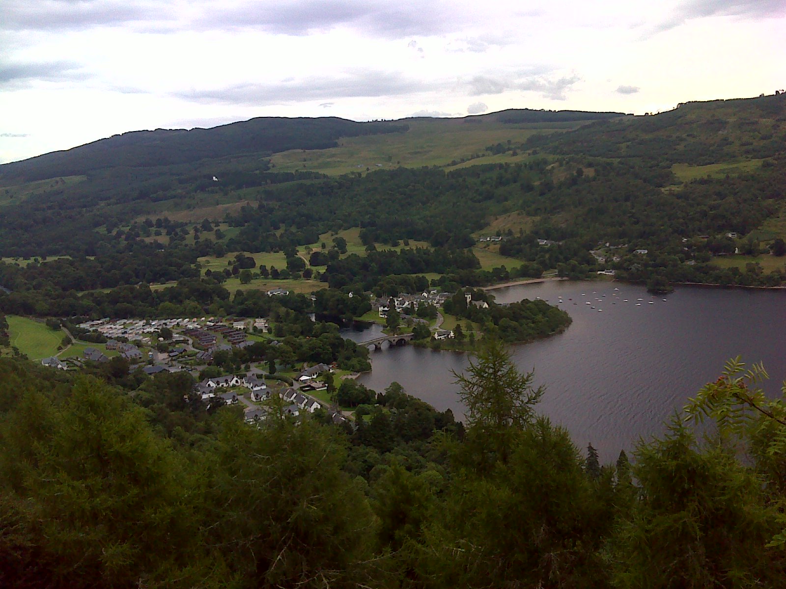
This section begins with a walk along a section of the Rob Roy Way, from the stunning Birks of Aberfeldy and the Moness Burn and up onto the hillside, providing unobstructed views of the valley below and the Munro of Schiehallion on the horizon. The path leaves the Rob Roy Way as it descends into the beautiful village of Kenmore, passing an array of fabulous properties on the way down.
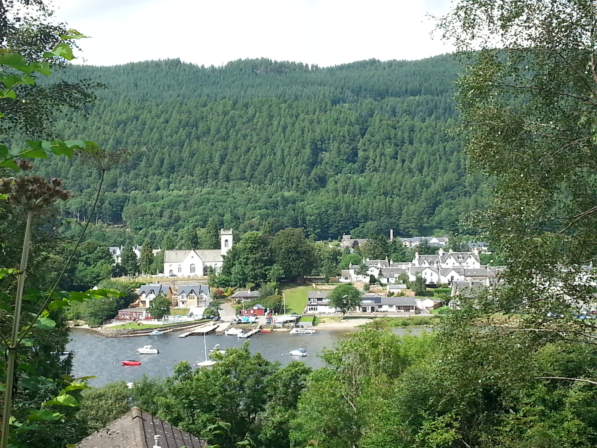
Stage 6: Kenmore to Fortingall
Distance: 6.5 miles / 10.40 km
Highest Point: 335 metres
After a stop off at the Kenmore Hotel, the second half of the day heads north and climbs through the Drummond Hill Forest before leaving the woods on the west side and descending onto the quiet country road which leads into the hamlet of Fortingall. Upon arrival, why not spare a few minutes to visit one of the oldest living things in Europe, the Fortingall Yew Tree, thought to be over 5,000 years old.
Stage 7: Fortingall to Kinloch Rannoch
Distance: 11.0 miles / 17.60 km
Highest Point: 709 metres
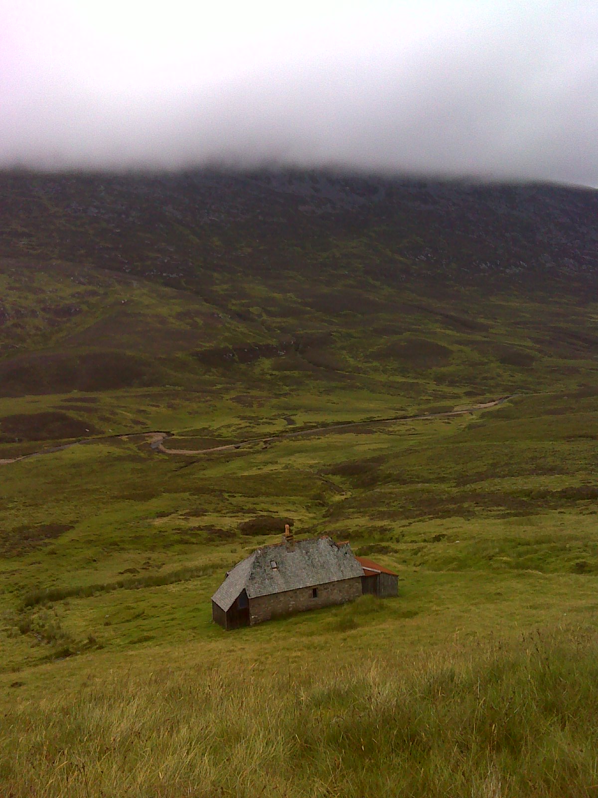
This stage represents the first real climb of the trail, reaching over 700 metres at the highest point. A typical highland landscape, the rough and barren terrain continues across the remote stretches of Glen Lyon, passing the Glenmore Bothy and into the shadow of the towering Munro of Shiehallion. This section required good map reading skills as the path is very faint and indistinct in places, particularly at the bothy. Once off the hillside, a country road leads to the village of Kinloch Rannoch. See below section on Deer Stalking and the Glenlyon Estate.
Stage 8: Kinloch Rannoch to Bridge of Gaur
Distance: 16.0 miles / 25.60 km
Highest Point: 430 metres
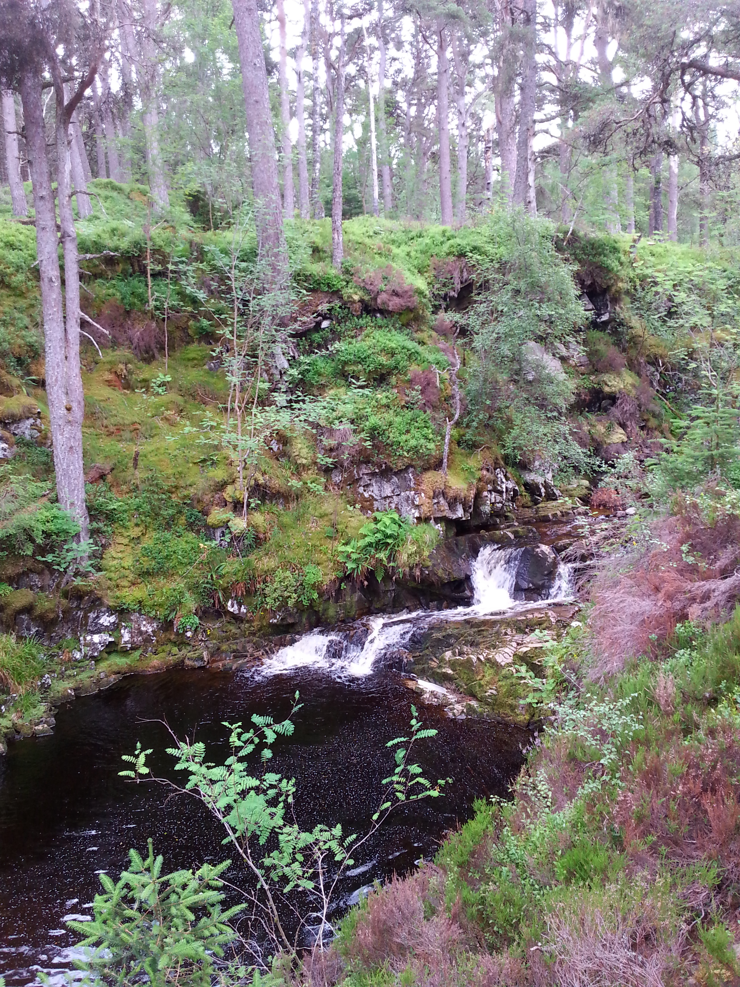
There are two options to this route, the first being a simple walk along the banks of Loch Rannoch on the country road. The second option, and much more rewarding, is the path which threads peacefully through the beautiful, ancient woodland of Rannoch Forest. This makes for a longer day, however is worth every step for which will undoubtedly be one of the highlights of the entire walk. Before reaching Bridge of Gaur, the route leaves Rannoch Forest and heads back into the open hillside and join’s the track which leads off the glen.
Stage 9: Bridge of Gaur to Rannoch Station
Distance: 5.5 miles / 8.8 km
Highest Point: 229 metres
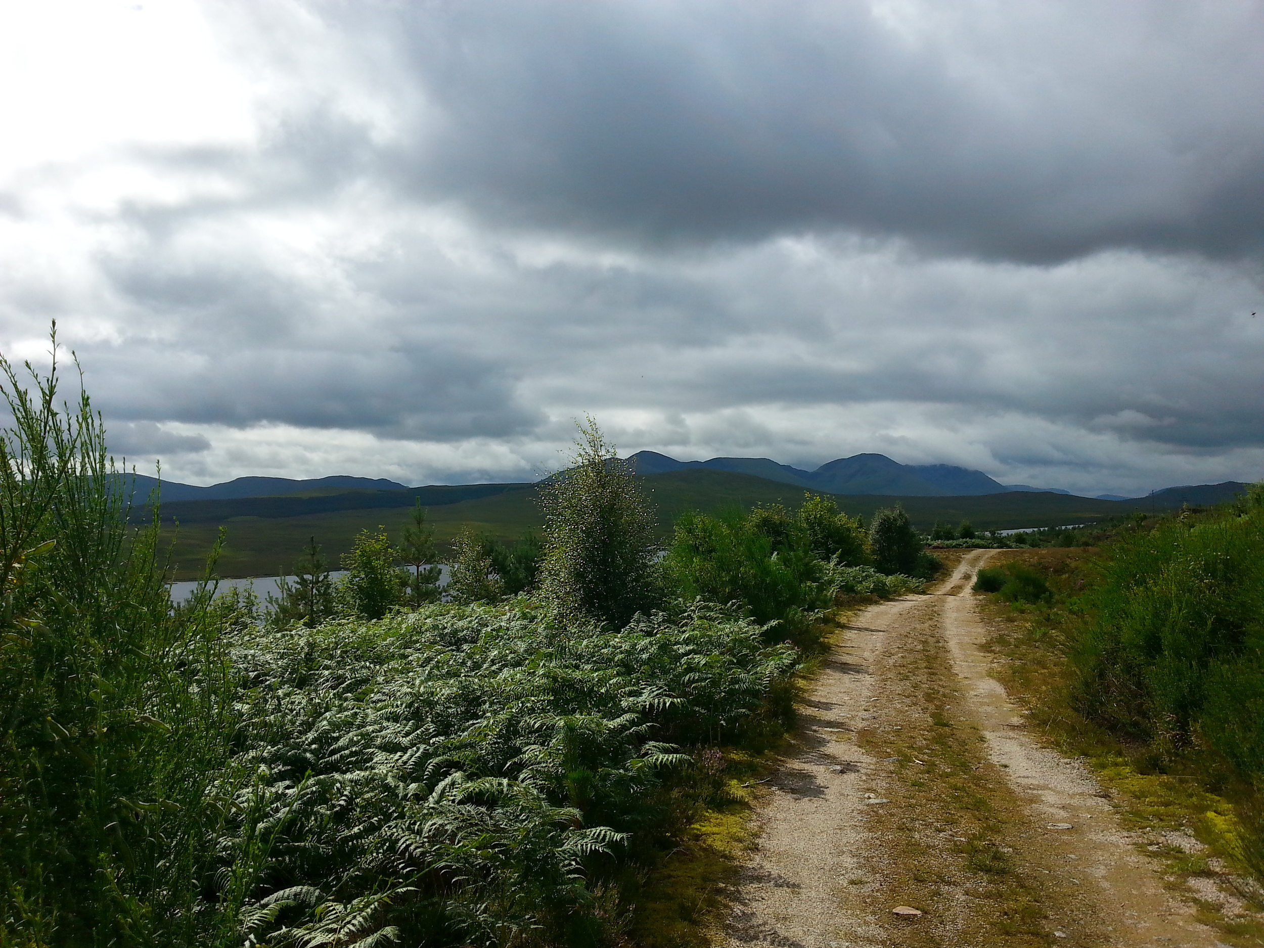
This stage involves a short, five mile walk along the country road to Rannoch Station. The landscape quickly changes from the rich and colourful setting of Loch Rannoch to the boulder strewn, damp and desolate terrain of Rannoch Moor. As the road ends at the railway station, walkers are required to transfer their main, overnight bags on a short train journey to Bridge of Orchy, before returning to Rannoch Station for the next day’s onward journey across Rannoch Moor.
Stage 10: Rannoch Station to King’s House Hotel
Distance: 12.50 miles / 20.0 km
Highest Point: 370 metres
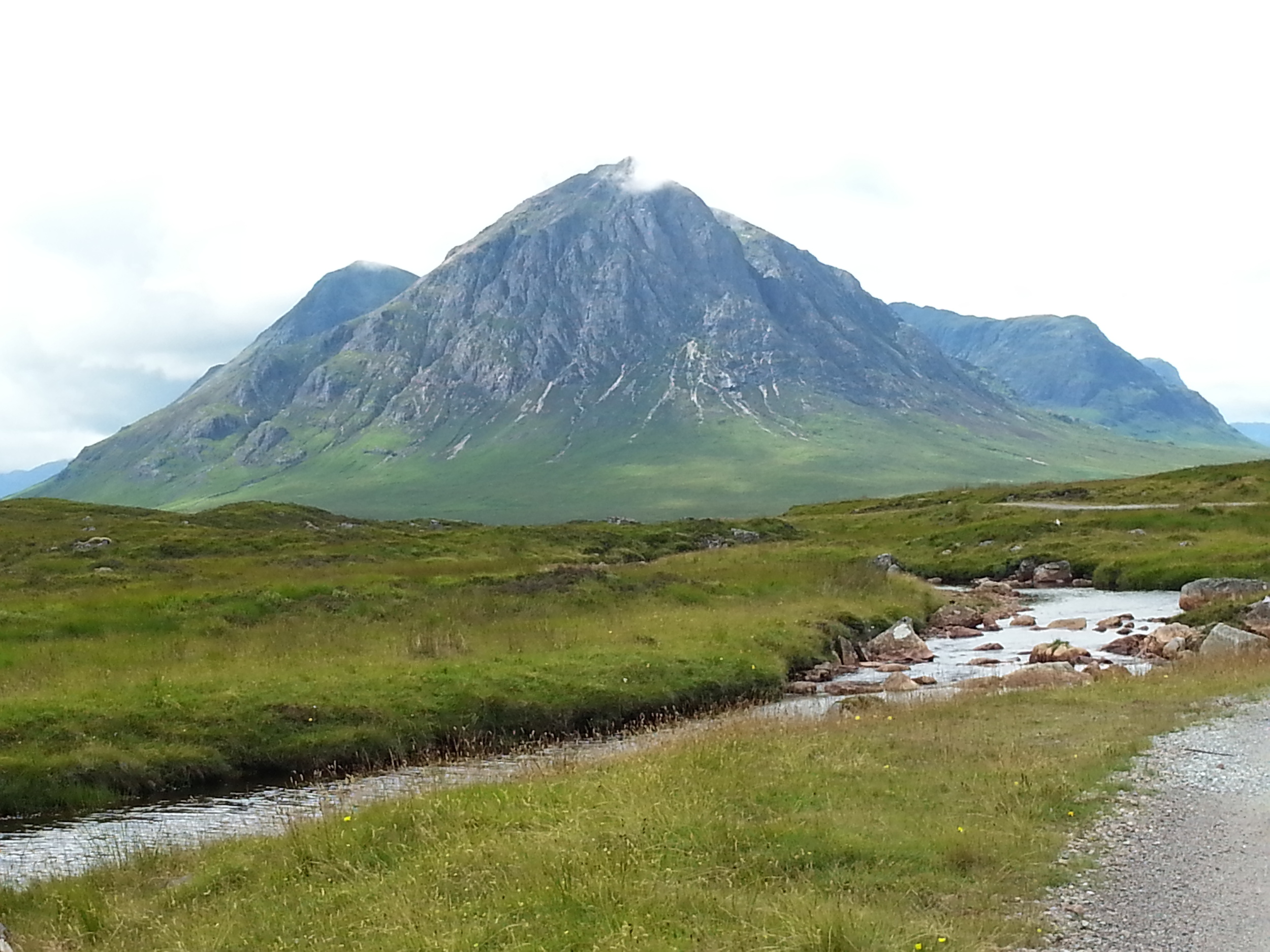
This stage can be split into three distinct sections – the track which travels through the old forest, the boggy section through the heart of Rannoch Moor, and the land rover track which leads to the Kings House Hotel at the gateway to the Glencoe mountain range. Whether it’s the hauntingly quiet forest path, the faint track across one of Europe’s last remaining wildernesses, or the stunning backdrop of the spectacular West Highland mountain range, this stage really is like no other.
Stage 11: King's House Hotel to Kinlochleven
Distance: 9.0 miles / 14.40 km
Highest Point: 550 metres
This is where the Coast to Coast Trail meets the West Highland Way. The path heads straight through Glencoe, eventually climbing up and over the mountain range via the ‘Devil’s Staircase’, the highest point on the WHW. Once at the top, looking back down towards the Kings House Hotel, it pays to think how dramatically the landscape has changed from the lowlands of the Perthshire countryside. The path then follows a long descent into Kinlochleven.
Stage 12: Kinlochleven to Fort William
Distance: 15.0 miles / 24.20 km
Highest Point: 330 metres
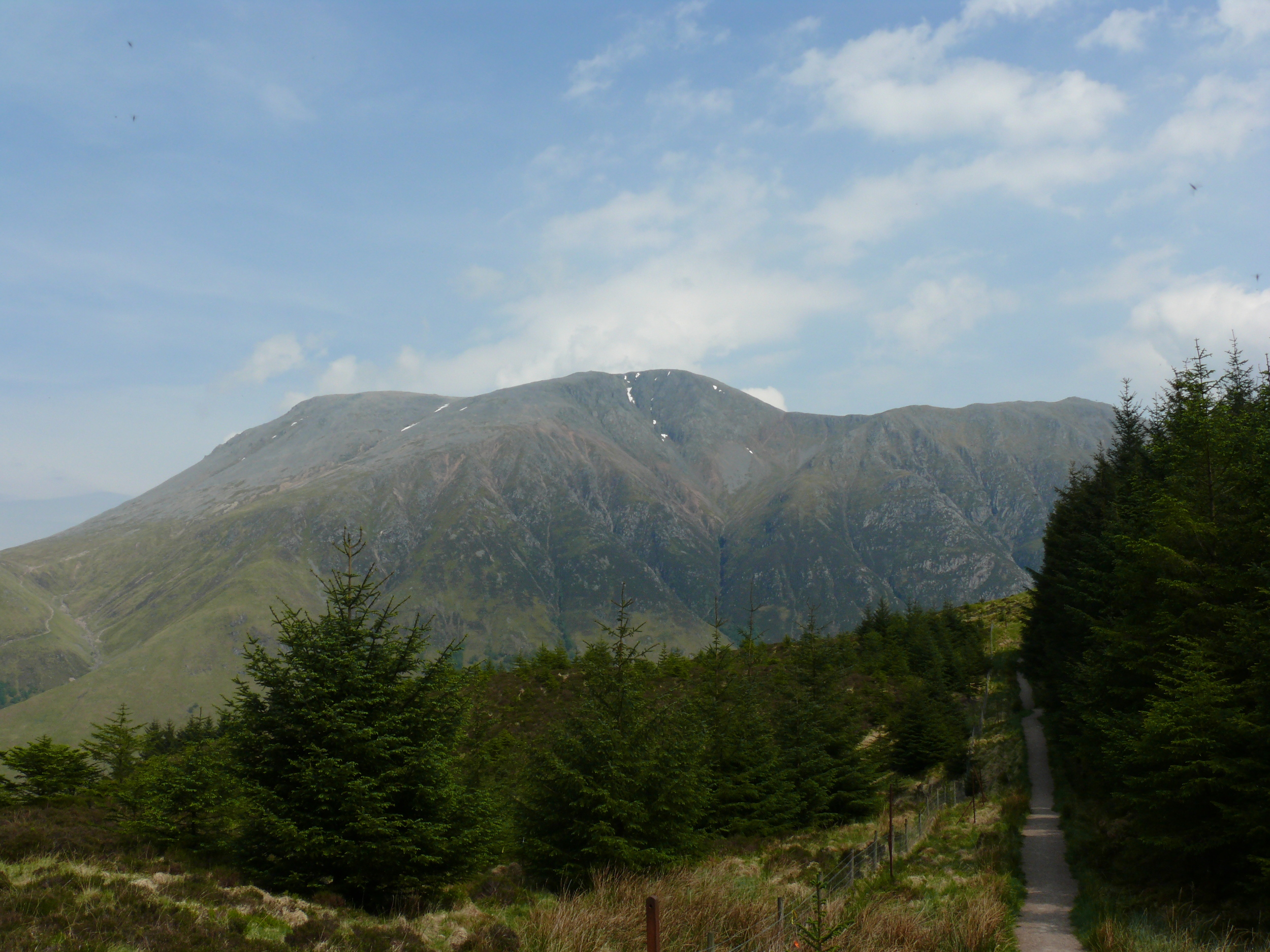
The final stage closes in on the Mamore mountain range as it climbs steeply out of Kinlochleven, where some of the best views of the entire walk can be found. Once this ascent has been cleared, the trail into Fort William is fairly level as it undulates along the old military road. As the path closes in on Glen Nevis, a number of forested areas are passed through, with Ben Nevis becoming more and more dominant on the horizon. A long forest track winds off the hill and into Fort William.
PRICES & ITINERARIES
| Tour Code | Walking Days/Nights | Ave. Miles Per Day | Price Per Person From |
| HEART1 | 10 Walking / 11 Nights | 12 | £990** |
What is Included?
Pre-booked Accommodation
Breakfast each morning (exclusions may apply)
Baggage Transfers
Exclusive WAS Heart of Scotland Guidebook
Info on transport and local services
What is not included?
Evening meals & packed lunches
Travel to Perth
Travel from Fort William
Travel Insurance
Please note this walking holiday is available from mid-April to mid-June. This is in order to avoid the beginning of the deer stalking season on the Glen Lyon Estate on 1st July.
ADDITIONAL INFORMATION
**Prices are based on 2 people sharing a twin or double room.
The trail hosts a variety of hotels and Bed and Breakfasts; from moderate to more expensive pricing tariffs. Individual preferences should be stipulated in the Holiday Booking Form
This package includes a one night stay in Fort William, however, additional nights at the end of the walk can be arranged to explore the highlands at your leisure, which could include a climb up Scotland's highest mountain, Ben Nevis. Walkers must organise their own return transport to Perth and beyond. Details of public transport services are available on request.
If you would prefer to walk the Heart of Scotland Trail using an alternative itinerary, please let us know and will do our utmost to tailor the holiday to your needs.
Extra Nights & Extending Your Stay
Many walkers choose to take rest days during the walking holiday; whether to give the feet a well-earned break, to do a little sight-seeing or perhaps a bit of ‘Munro-bagging’. There is also the possibility of staying on in Fort William to perhaps climb Ben Nevis or visit one of the many other tourist attractions in the area. If this option is of interest, please let us know on the booking form.
Accommodation
Each Hotel and Bed & Breakfast has been hand-picked to ensure you enjoy the most welcoming, comfortable and value-for-money experience on the Heart of Scotland route. A warm welcome awaits all walkers and hikers, with hotel owners keen to hear stories of the day’s adventures. Evening meals and packed lunches for the onward journey are available at most hotels and B&B's, however, please note that they are NOT included in the holiday package.
Navigation
The route is not way marked or signposted, other than the stages which follow the Rob Roy Trail and the West Highland Way. The route follows narrow paths at times, some of which can be obscured by overgrown heather, bracken and other Highland undergrowth. For this reason, we must insist maps and a compass are carried at all times. As well as the Guidebook, your package includes detailed Ordnance Survey maps of the entire route. WAS highly recommend that at least one member of your party is a competent map and compass reader.
Dogs
Unfortunately, due to restrictions imposed by some places of accommodation, dogs are not permitted on this walk.
Travel Insurance
WAS highly recommends that all walkers have suitable travel insurance.
Enjoying Scotland Responsibly
The Scottish Outdoor Access Code is a set of guidelines issued by The Scottish National Heritage Trust. The Scottish Outdoor Access Code provides detailed guidance on the responsibilities of those exercising access rights and of those managing land and water. By doing so, the Code provides a practical guide to helping everyone make informed decisions about what best to do in everyday situations.
Each holiday information pack will include a copy of the Outdoor Access Code Summary Leaflet, including details of where the full code and A-Z guide can be downloaded.
| DATE | ITINERARY | DISTANCE |
| Pre-Walk/Night 1 | Arrive in Perth (overnight accommodation) | n/a |
| Day 1 | Perth to Bankfoot | 11.30 miles / 17.92 km |
| Day 2 | Bankfoot to Dunkeld | 9.33 miles / 15.02 km |
| Day 3 | Dunkeld to Aberfeldy | 17.00 miles / 27.20 km |
| Day 4 | Aberfeldy to Fortingall | 15.30 miles / 24.30 km |
| Day 5 | Fortingall to Kinloch Rannoch | 11.90 miles / 19.20 km |
| Day 6 | Kinloch Rannoch to Bridge of Gaur | 15.80 miles / 25.60 km |
| Day 7 | Bridge of Gaur to Rannoch Station ** | 5.50 miles / 8.80 km |
| Day 8 | Rannoch Station to Kings House Hotel | 12.50 miles / 20.00 km |
| Day 9 | Kings House Hotel to Kinlochleven | 8.00 miles / 12.80 km |
| Day 10 | Kinlochleven to Fort William | 15.00 miles / 24.20 km |
** On the day you walk to Rannoch Station, you will stay for a second night at Bridge of Gaur. WAS will pre-arrange a return transfer to your B&B, details of which will be included within the Information Pack.
Luggage Transfer
Unlike the West Highland Way, there is no single dedicated baggage transfer service along the Heart of Scotland Trail, however, we have arranged for local transport operators and hoteliers to provide an equivalent service, ensuring your heavier bags will be transferred and delivered safely to your next place of accommodation.
Transport & Travel
Although travel to Perth and from Fort William is not included in the holiday package, we are more than happy to provide details of public transport services.
To Perth – There are excellent train and bus services, allowing easy access from Glasgow and Edinburgh to the south, and Inverness and Aberdeen from the north.
From Fort William – The main routes out of Fort William is by bus and train to Glasgow. The journey, whether by rail or coach, is an absolutely glorious trip with stunning scenery throughout. This really is the perfect way to end a memorable holiday.
Transport links will be detailed in your holiday package information pack.
Minimum Group Size
Please note that; as there are some sections of this route which pass through remote hills, forests and countryside, the minimum group size for this holiday is two people. The safety of our walkers is of the utmost importance and we would not want to risk the possibility of a solo walker becoming injured or disorientated in an area where there are no other people around to help.
Hill-walking and Deer Stalking
Scotland has fantastic hill-walking opportunities, but summer and autumn are also important times for deerstalking,which supports the local economy and is essential for sustainable deer management. The following options offer some advice to help walkers and land managers have a great day on the hill.
From 1st July to 20th October (the stag stalking season) you should:
Take reasonable steps to find out where stalking is happening, such as looking at;
Heading for the Scottish Hills,http://www.outdooraccess-scotland.com/outdoors-responsibly/access-code-and-advice/scottish-hills/heading-scottish-hills), orleaflets and signs;Follow reasonable requests on alternative routes on days stalking is taking place;Not cross land where stalking is taking place;Avoid wild camping where stalking is planned for the next day
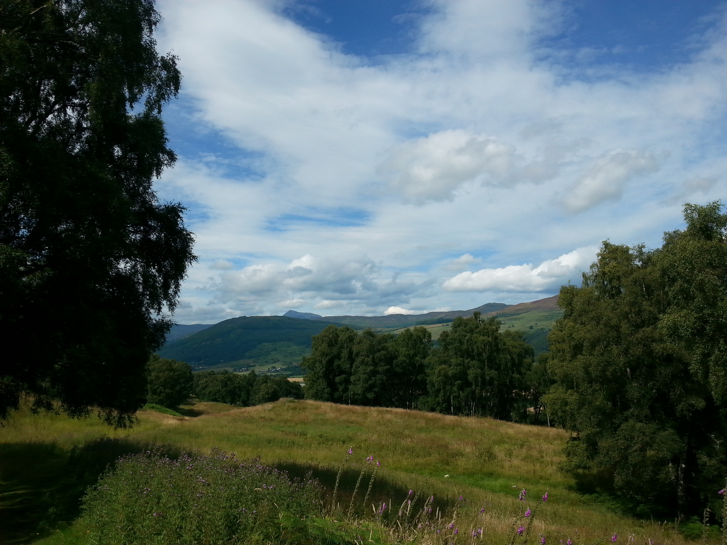
Gallery